An adventure in the Pyrenees came about by telling a friend about his hike in the national park, Valle de Ordesa. He described a beautiful valley where the mountains towered majestically. He described how the hike starts in dense vegetation with beautiful waterfalls at the bottom of the valley and then reaches a spectacular view when you leave the valley and come up the mountainsides of the national park. What he told me about sounded like a very beautiful place with opportunities for nice hikes. I also wanted to make a summit trip to some mountain top and most preferably see more than just the valley he described. I therefore further investigated whether the hike could be done as a tour instead of wandering in and out through the Valle de Ordesa as he had done. It's always nicer to get to see new places all the way, than to have to turn around and walk the same way back.
I found a very appealing walking tour where you could start from the village of Torla in the Spanish Pyrenees through the valley of Ordesa up into the mountains via a mountain station Refugio de Gorize and to a mountain pass over on the French side of the Pyrenees. Then you would also have to hike up a very beautiful mountain pass, Brecha De Roland and from there across the border into France to a mountain station, Refuge des Sarradets on the French side further down through a valley and back on a lower road again to the Spanish side and back to Torla! That round looked very promising. I came to suggest this to another friend with whom I have been hiking both in Jämtland and Abisko in Sweden by now. We started piecing together the adventure with all its components, the flight to Barcelona, plus a half day's drive by rental car to Torla to hike this tour. In total, we would get to this in a week. And the hike itself should not take more than three four nights and days and then we had also put in a day of summit hike to the highest mountain in the surroundings Monte Perdido, 3349 m.a.s.h.
For me, it would be the first time I have made a hike in such a warm temperature that Spain can have during its summer in July. It was also more uncertain how much water you need to carry and can access along the road. In the Nordic countries, fresh water is available all year round via all the streams and lakes in abundance in the mountains, so you rarely need to carry more than a pint of water. But here we were prepared to carry several liters each if necessary.
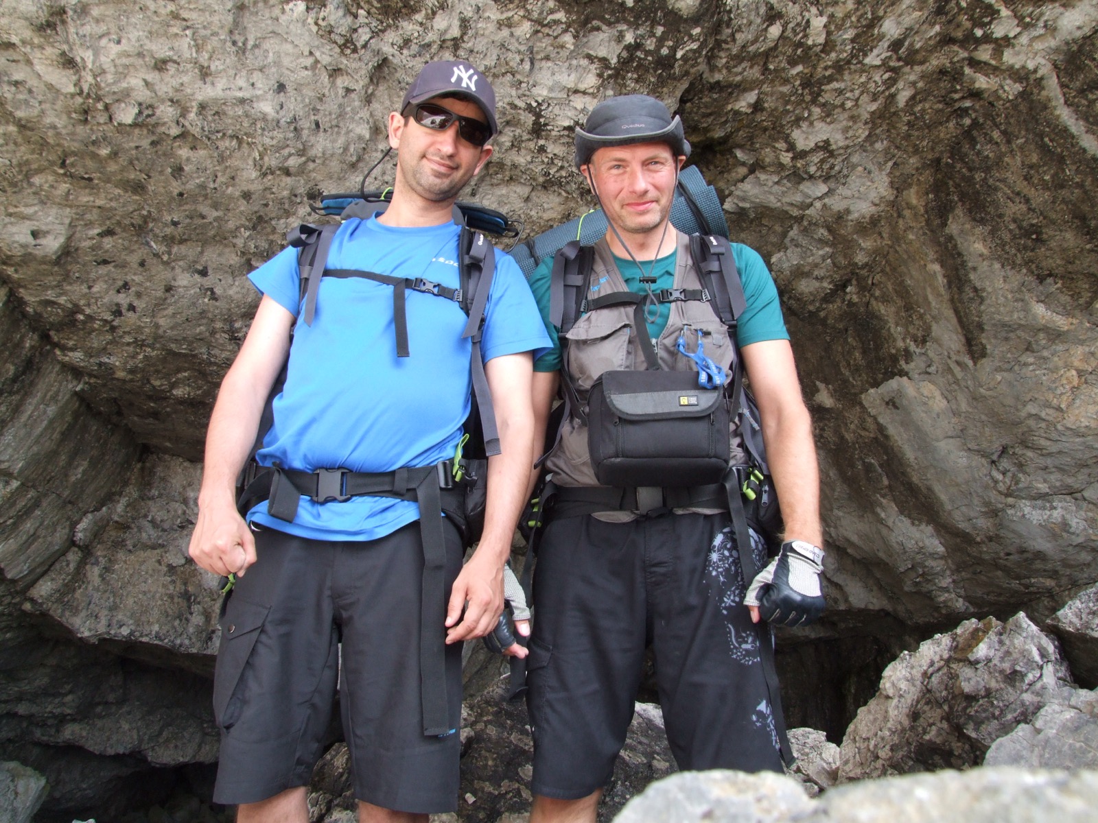
Our trip started with a day of victualling in Barcelona before we took the rental car towards the Pyrenees and the village of Torla which was our destination and starting point. We spend the following day in the car along the 330km long country road to arrive in the afternoon to the campsite we booked next to the national park. We fell asleep expectantly in the tent over tomorrow's starting stretch into the park.
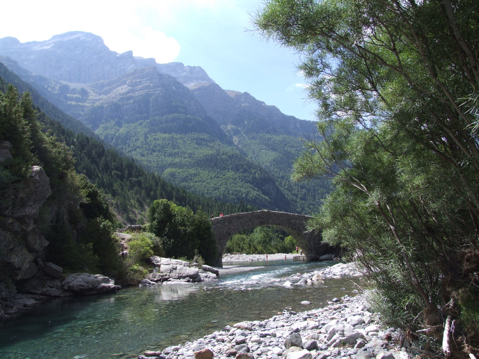
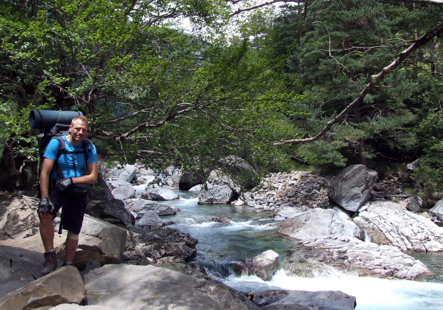
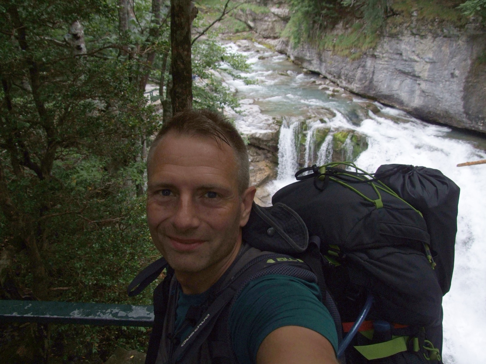
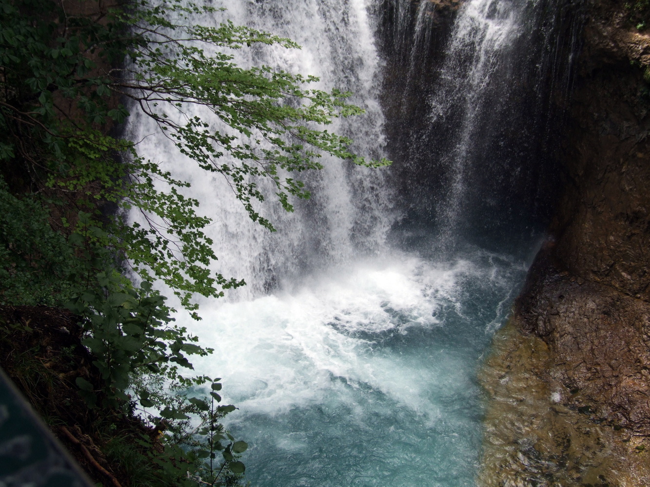
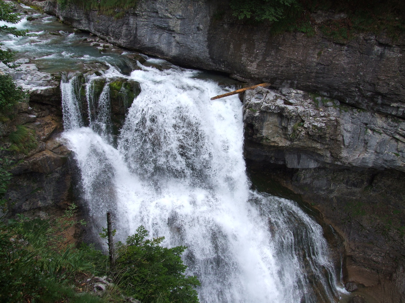
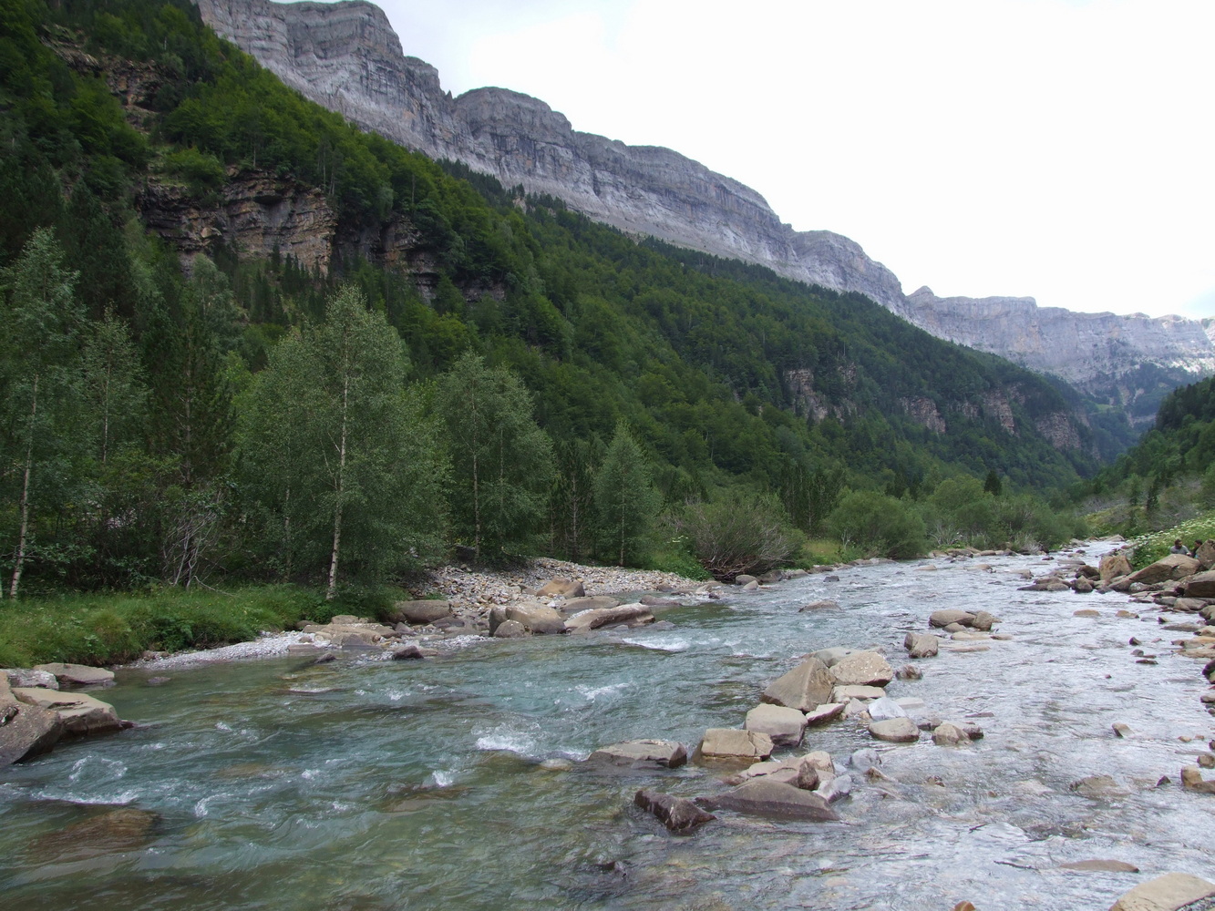
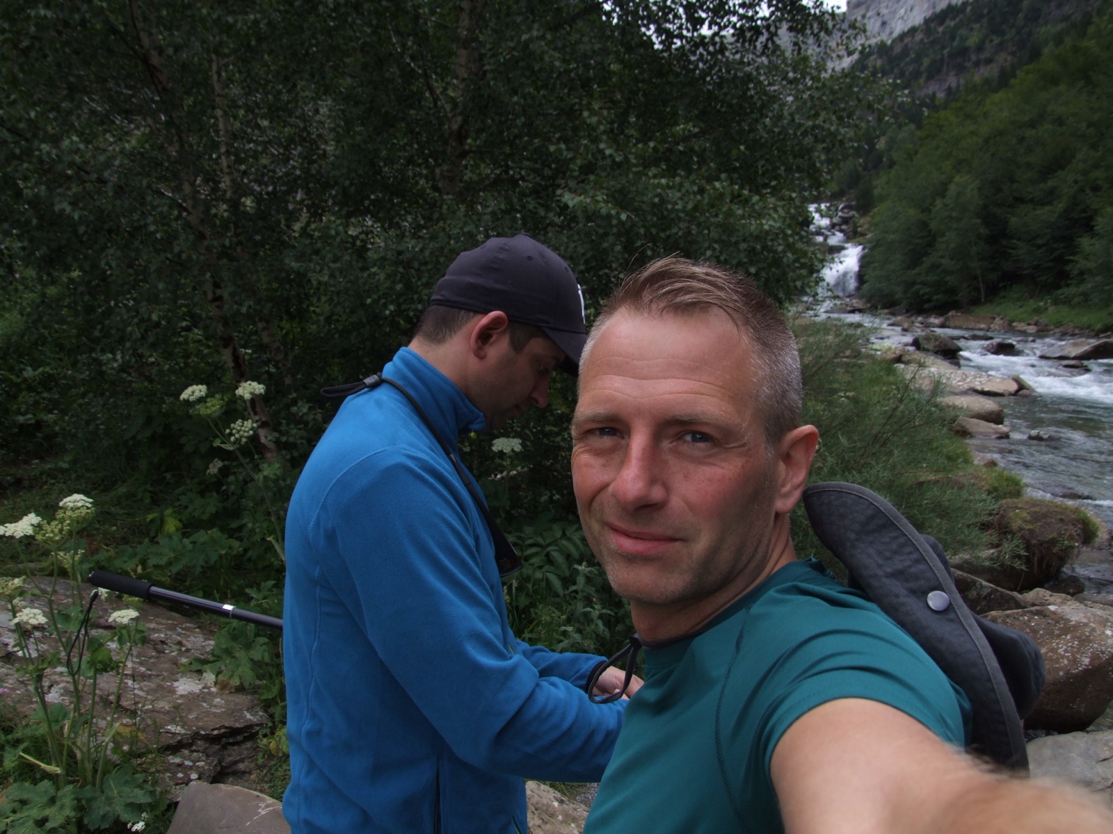
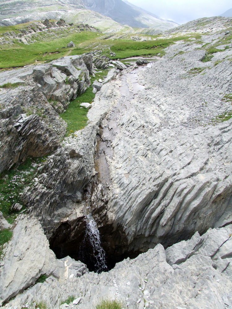
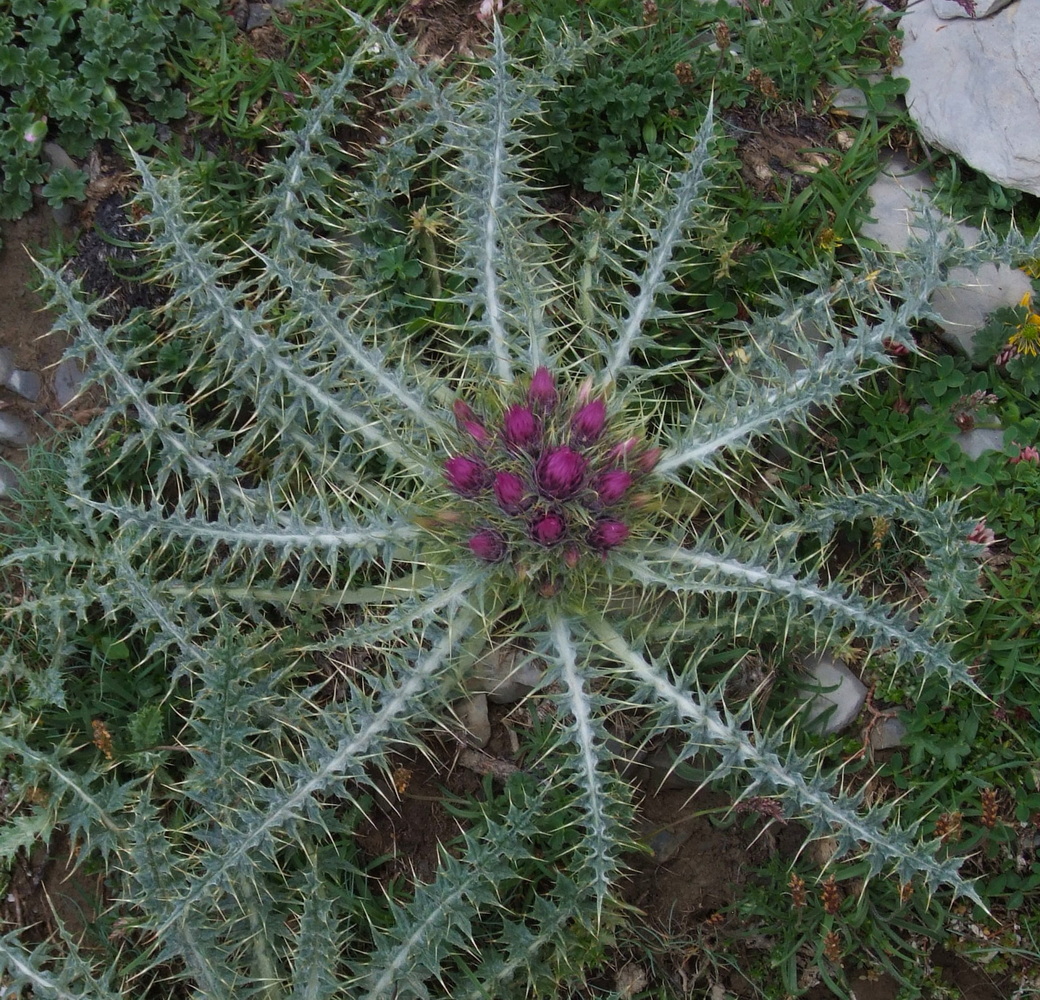
With full packing, it was time to take the first steps on this hike that went along the “Rio Arasaz” river. It was hot and humid in the deep valley. Here around the river there was a lot of vegetation but the sun barely even reached over the encircling mountainsides. So even where the sun could access, there was still shade from the canopy. Of course, we were grateful for that in the heat of over 25 degrees Celsius. As always when going out, the first day of any hike is something that the body needs to get used to. The backpack, the heat, and whatever the type of terrain it is, I have learned that on the first day you benefit from taking it extra easy. Know how the equipment fits. Correct if something chafes. Be kind to yourself with taking frequent breaks, and drinking a little continuously. We had a very nice starting distance that was made to stop and contemplate the beautiful waterfalls and be able to flash the icy water in the face to cool off before the upcoming climb. Here at the bottom of the valley, I discovered that my GPS Etrax had trouble finding enough satellites because the mountains were simply so steep and the valley so narrow that it lost position over and over again. There was no problem as this first part followed a clearly visible path and there was not much room to get lost as we had the slopes close by.

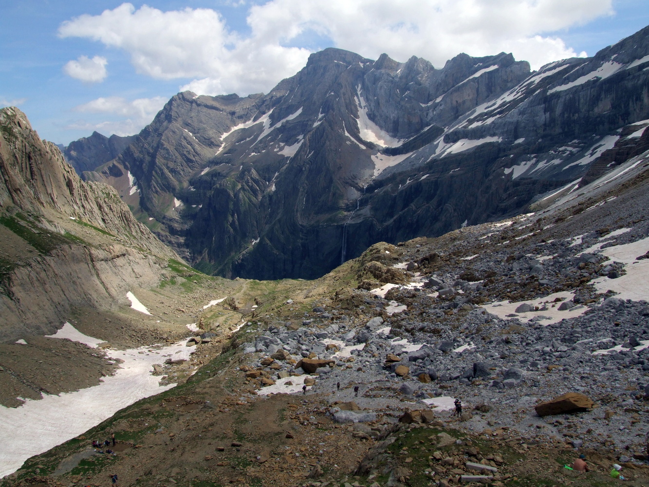
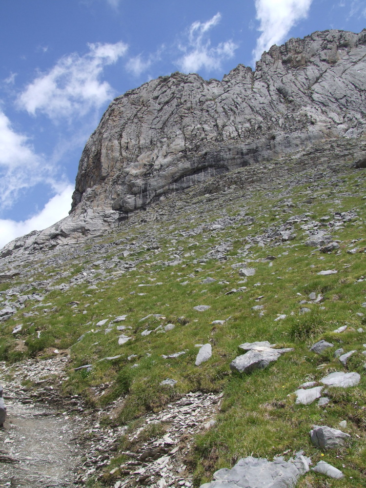
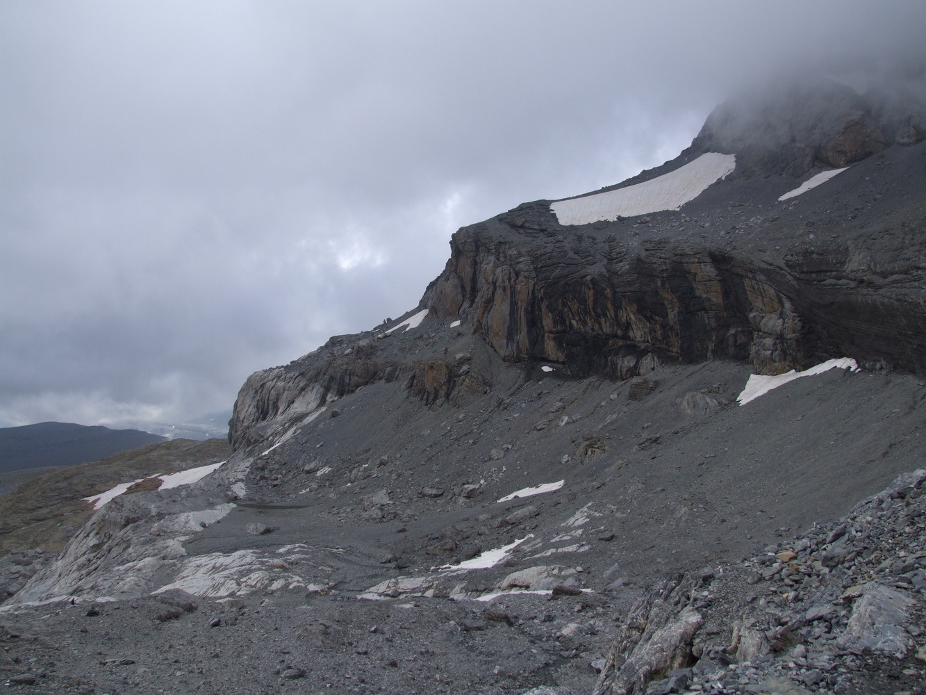
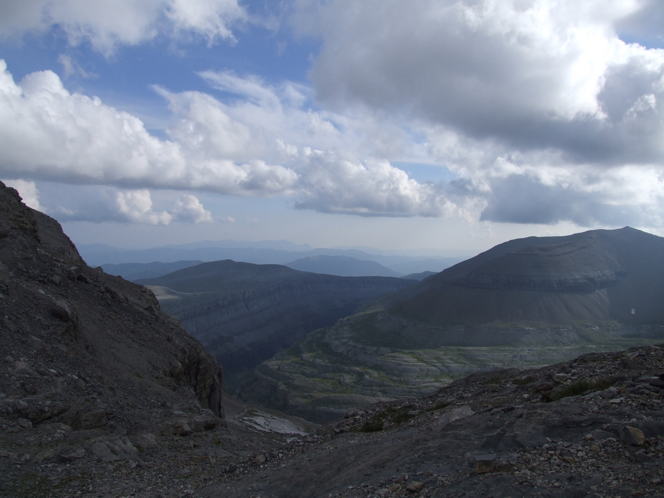
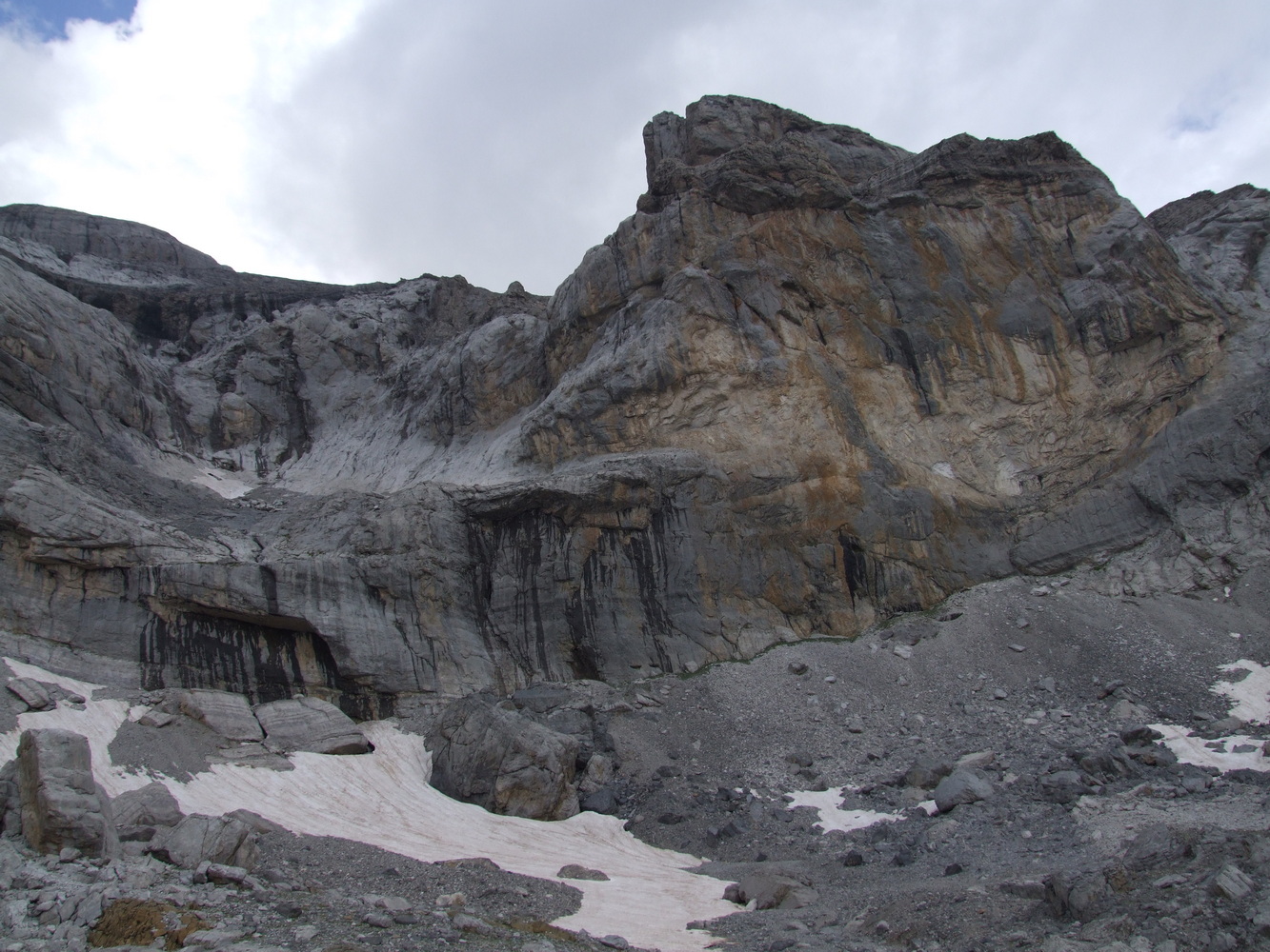
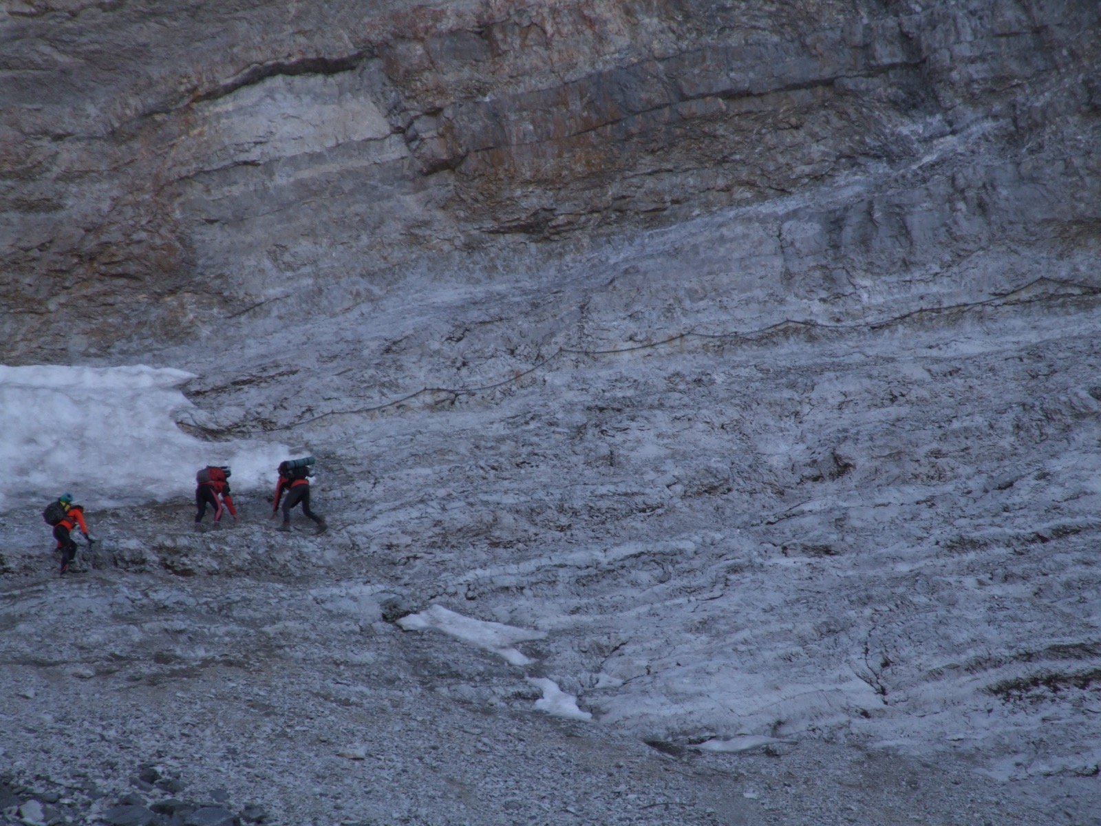
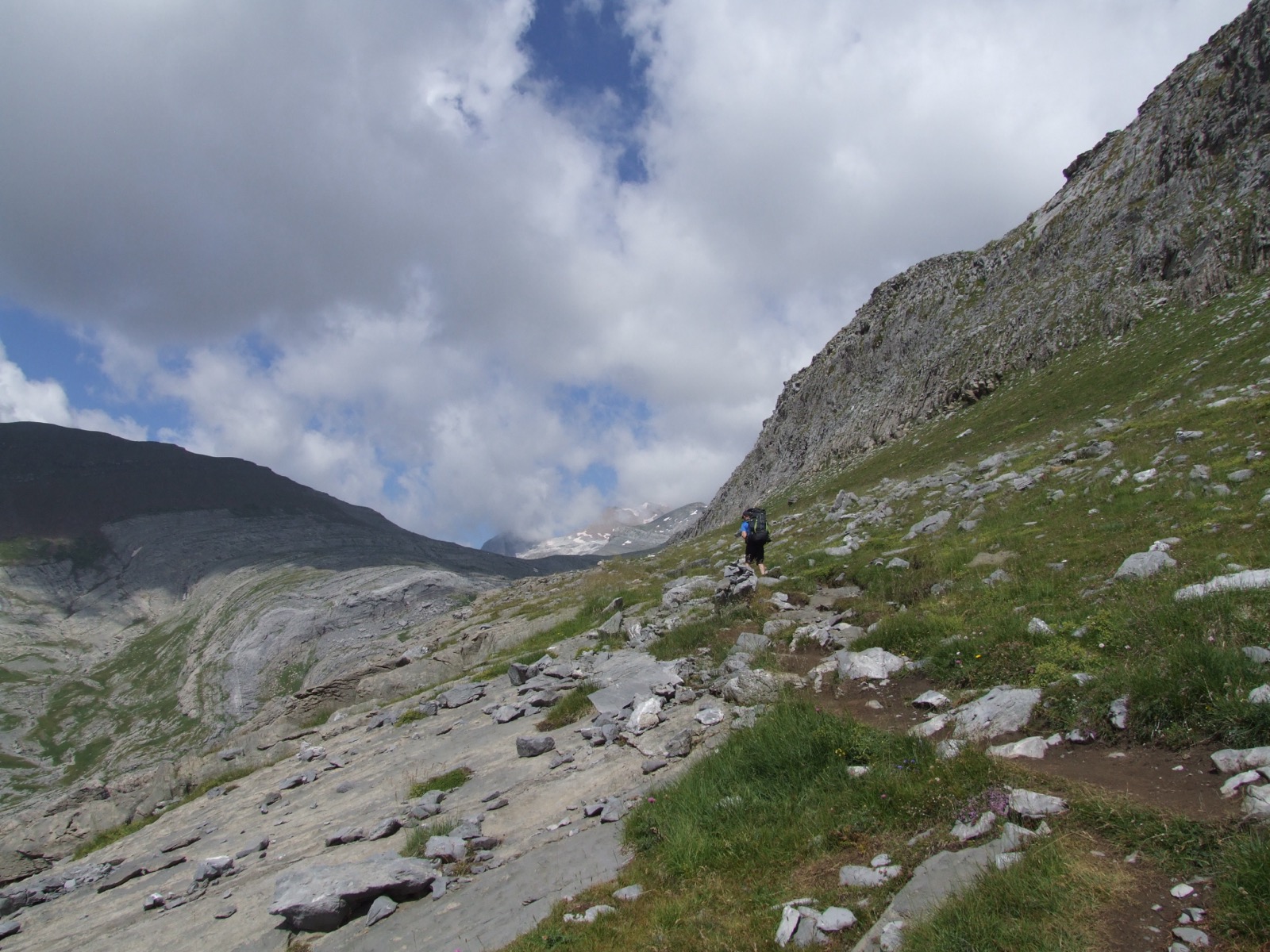
By the time we had wandered for a few hours, we had come to what looked to be a wall. My friend wondered where to go now as the climb ahead of us from afar looked completely impossible. I squinted up towards the top of the mountain plateau which was about 500 meters of altitude of what looked to be near vertical ascent and saw there some small dots moving along the serpentine paths up the mountain wall. Looks like we're going up there I pointed. We looked at each other and realized that now it starts for real. All we had to do was bite together and start the trek up the steep mountain wall. Now we had to test our endurance but the view was reward for the effort. And even though we got out in the sun, the temperature dropped slightly the higher we got up. The wind was also blowing easily so we didn't complain, the views over the valley were magnificent.


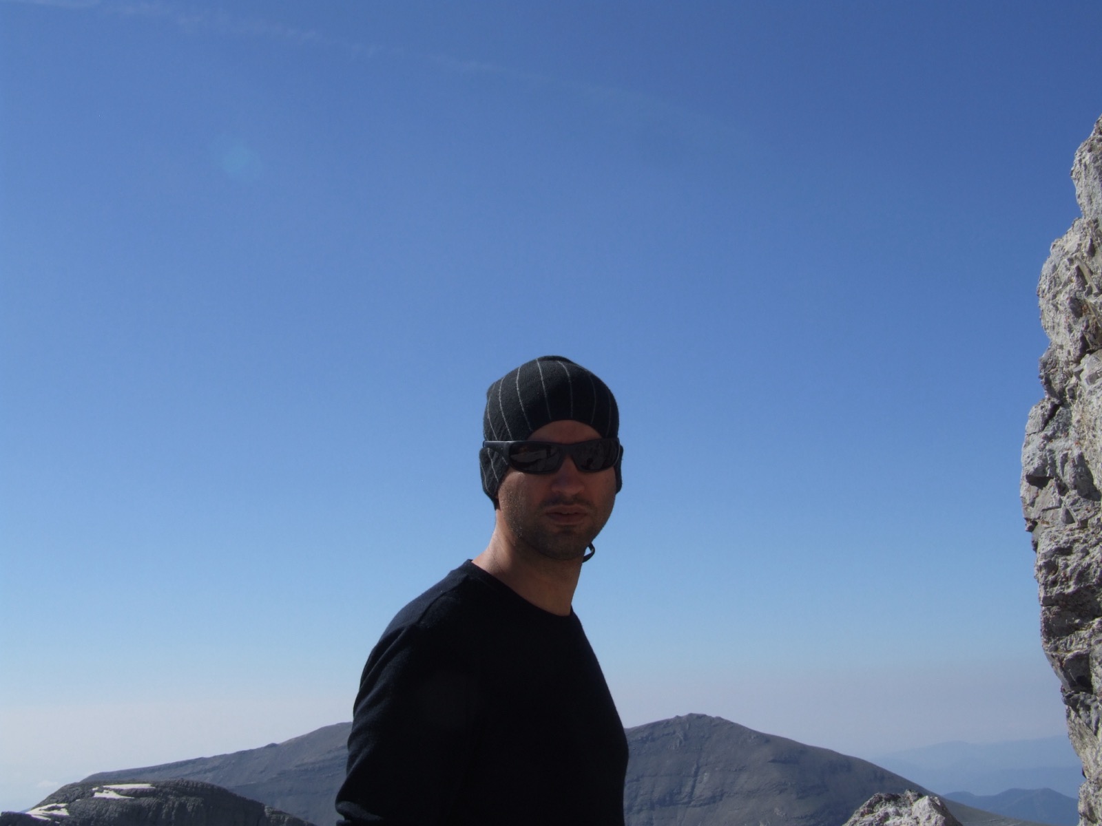
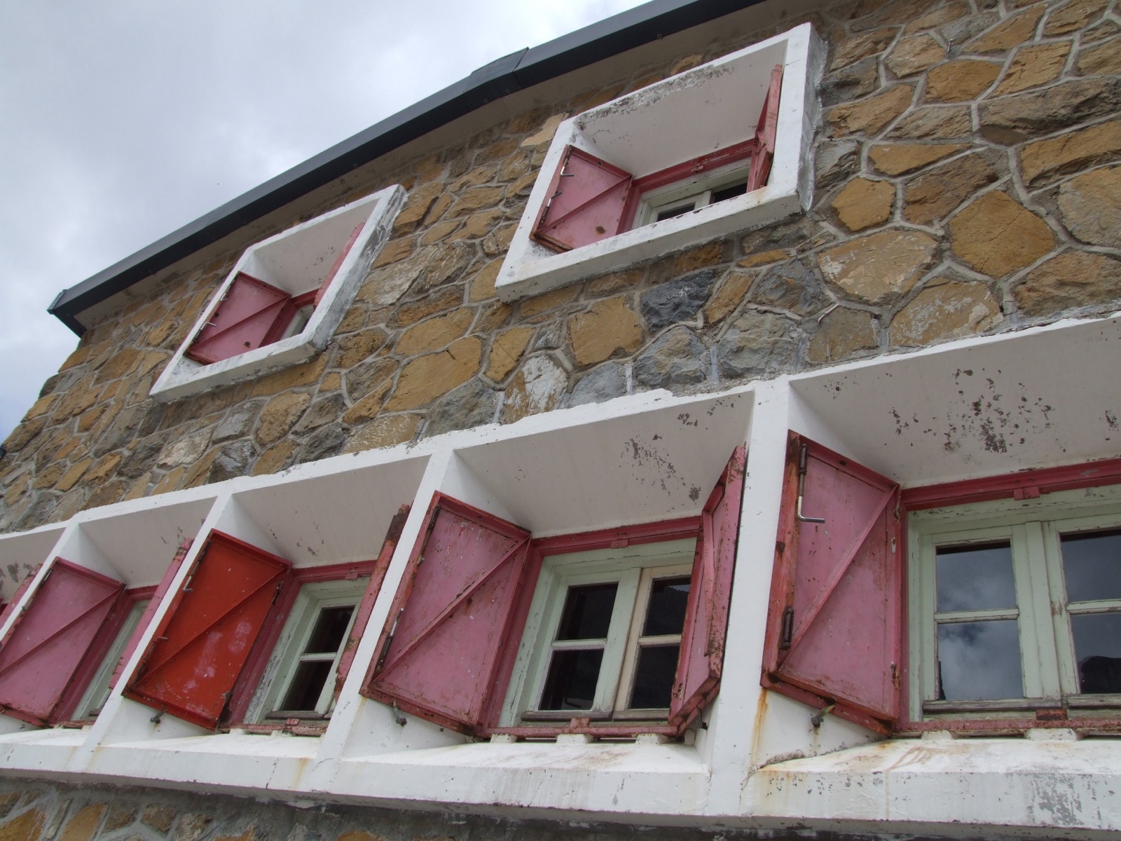
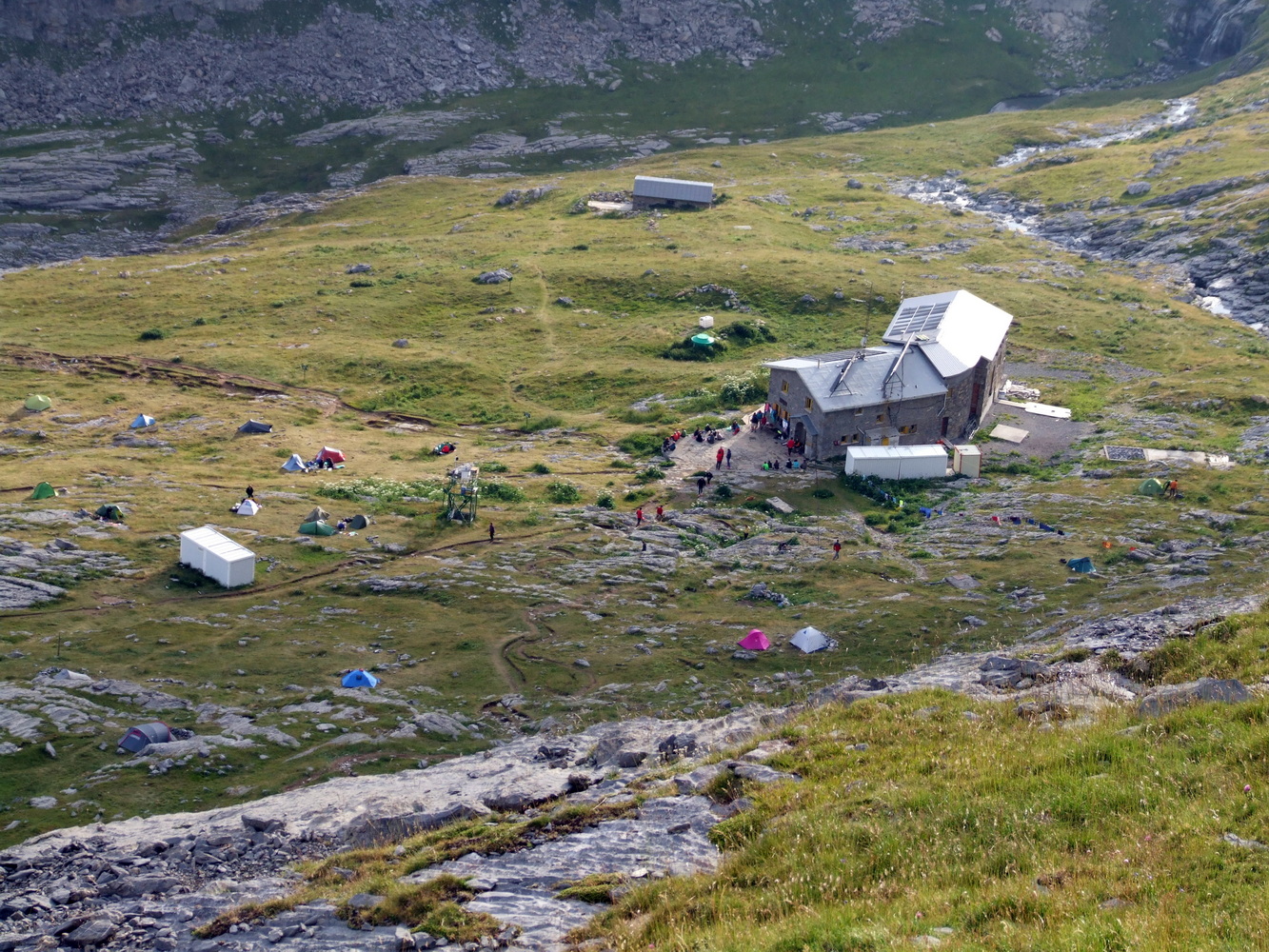
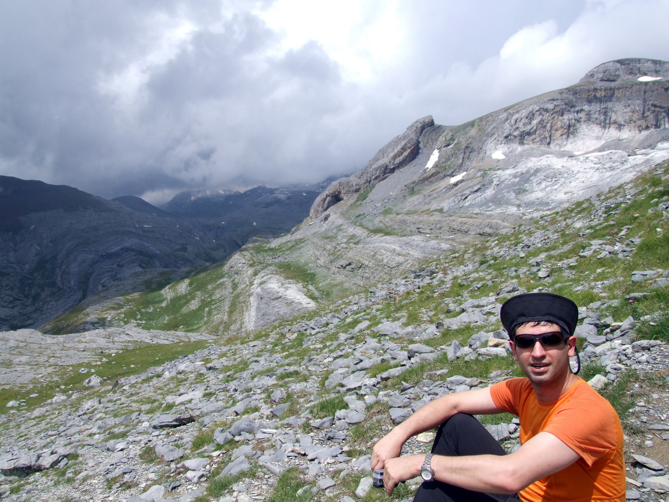
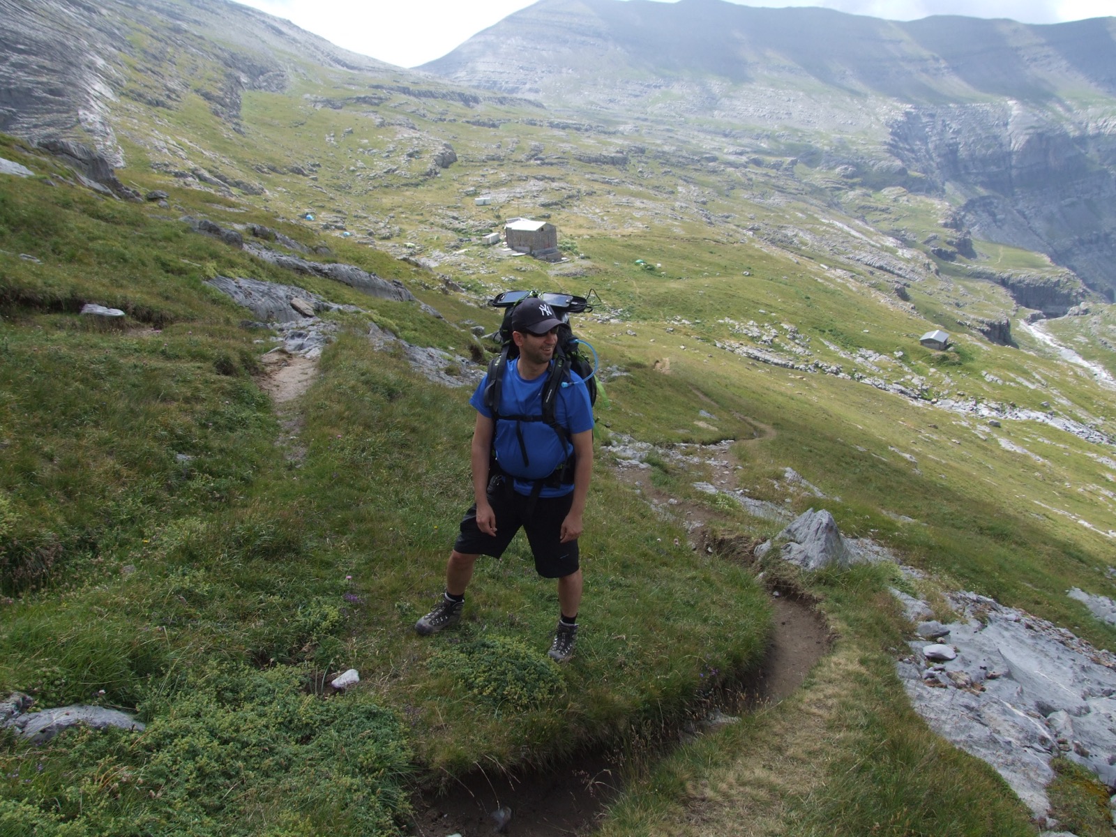
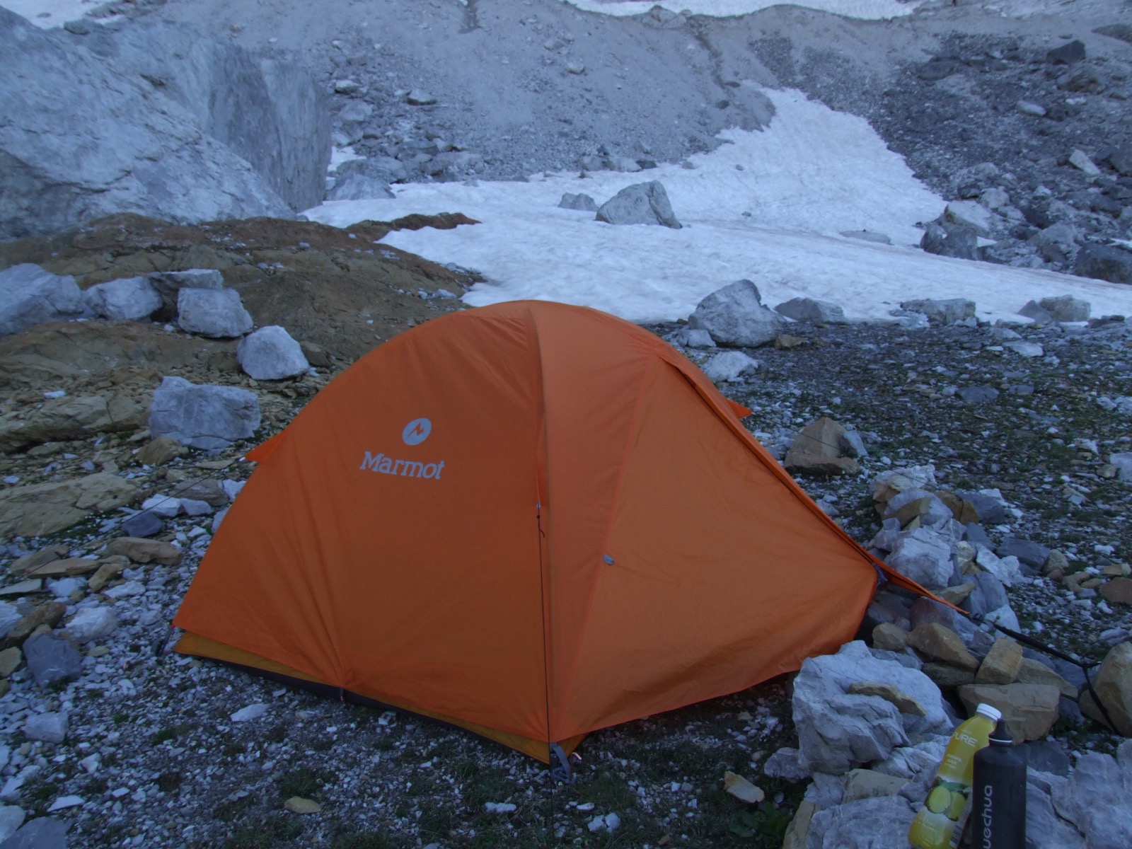
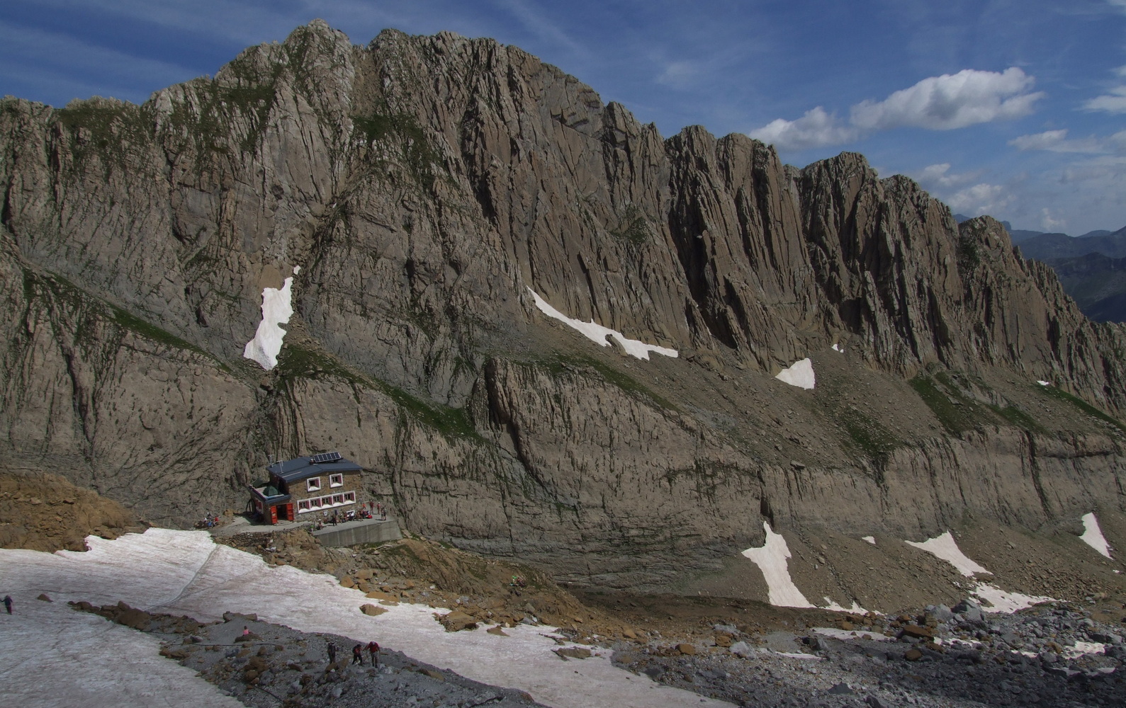
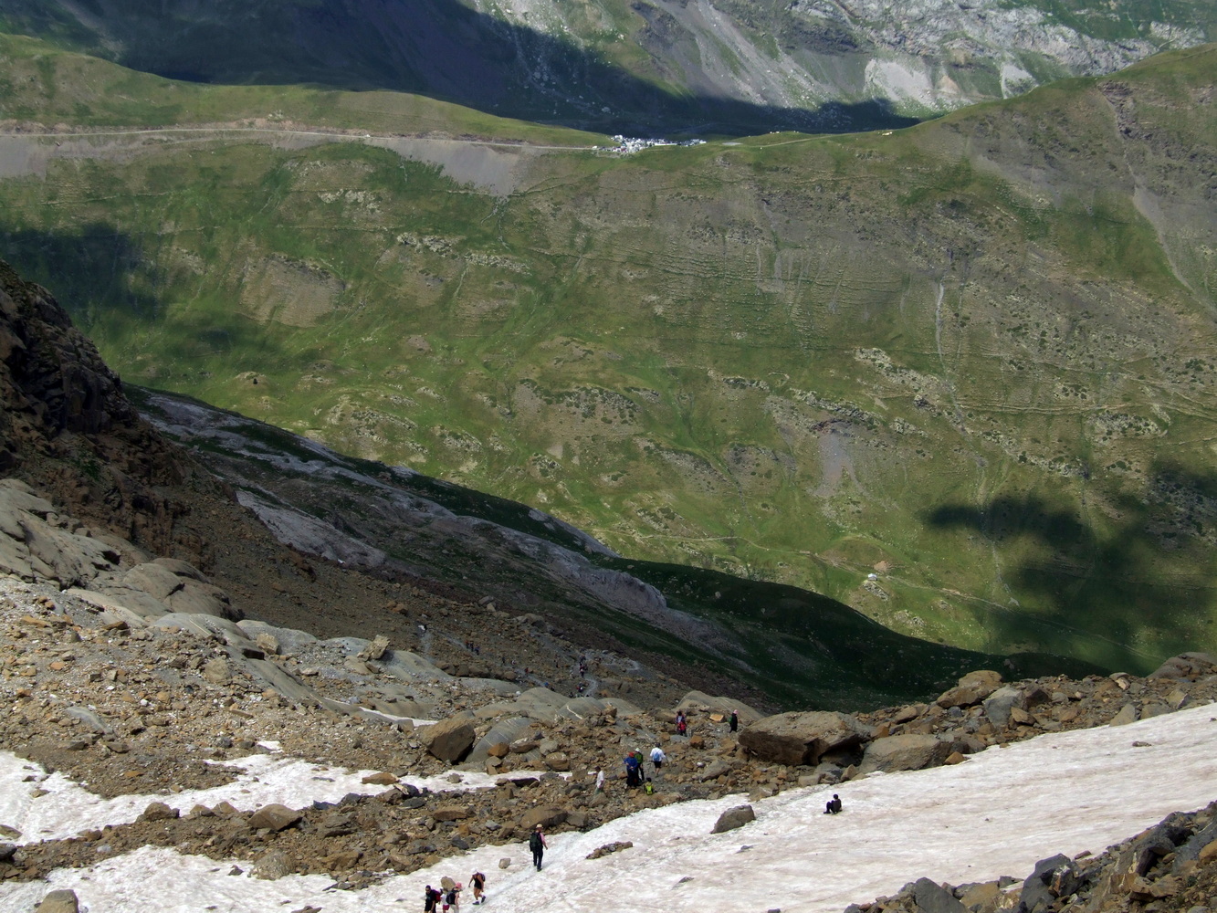
It was a heavy hike up the valley that had begun at 1000 m.a.s.h. and when we arrived at Refugio de Goriz at six o'clock in the evening, we had walked almost seven hours, about 15 km and reached an altitude of 2100 m.a.s.h. Here we pitched our tent in the evening sun and puffed out. Around this mountain hut there was bustling activity. Many hikers depart from here to various parts of the national park. We pondered the whole thing a bit up the mountain before returning down to the lodge for a cooked supper in the cabin.
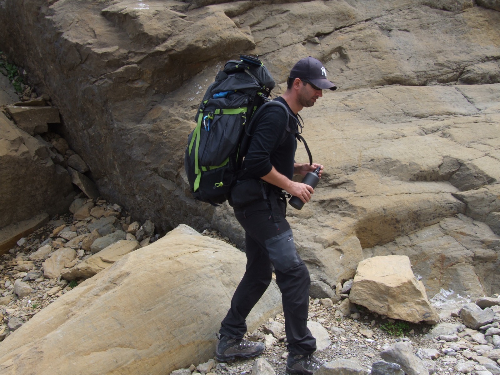
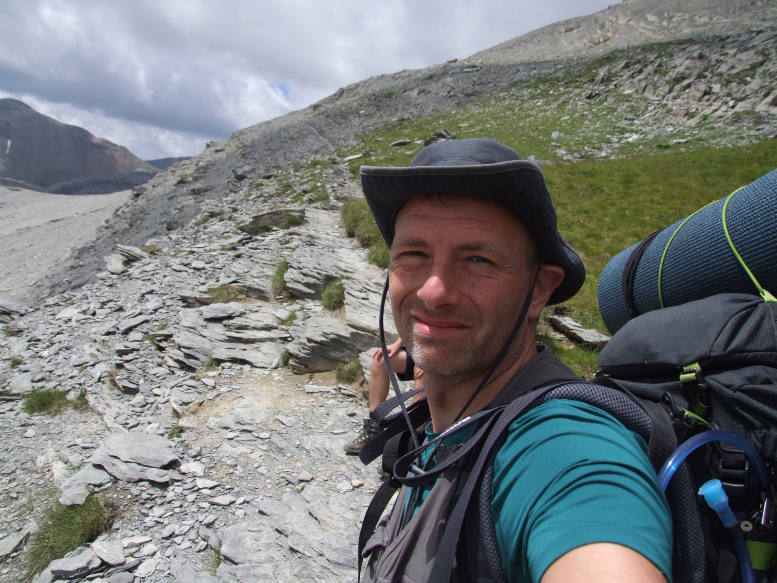
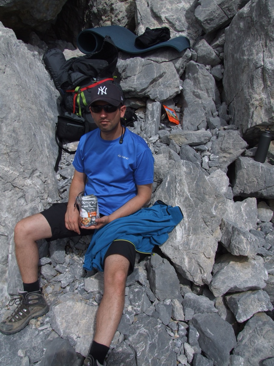
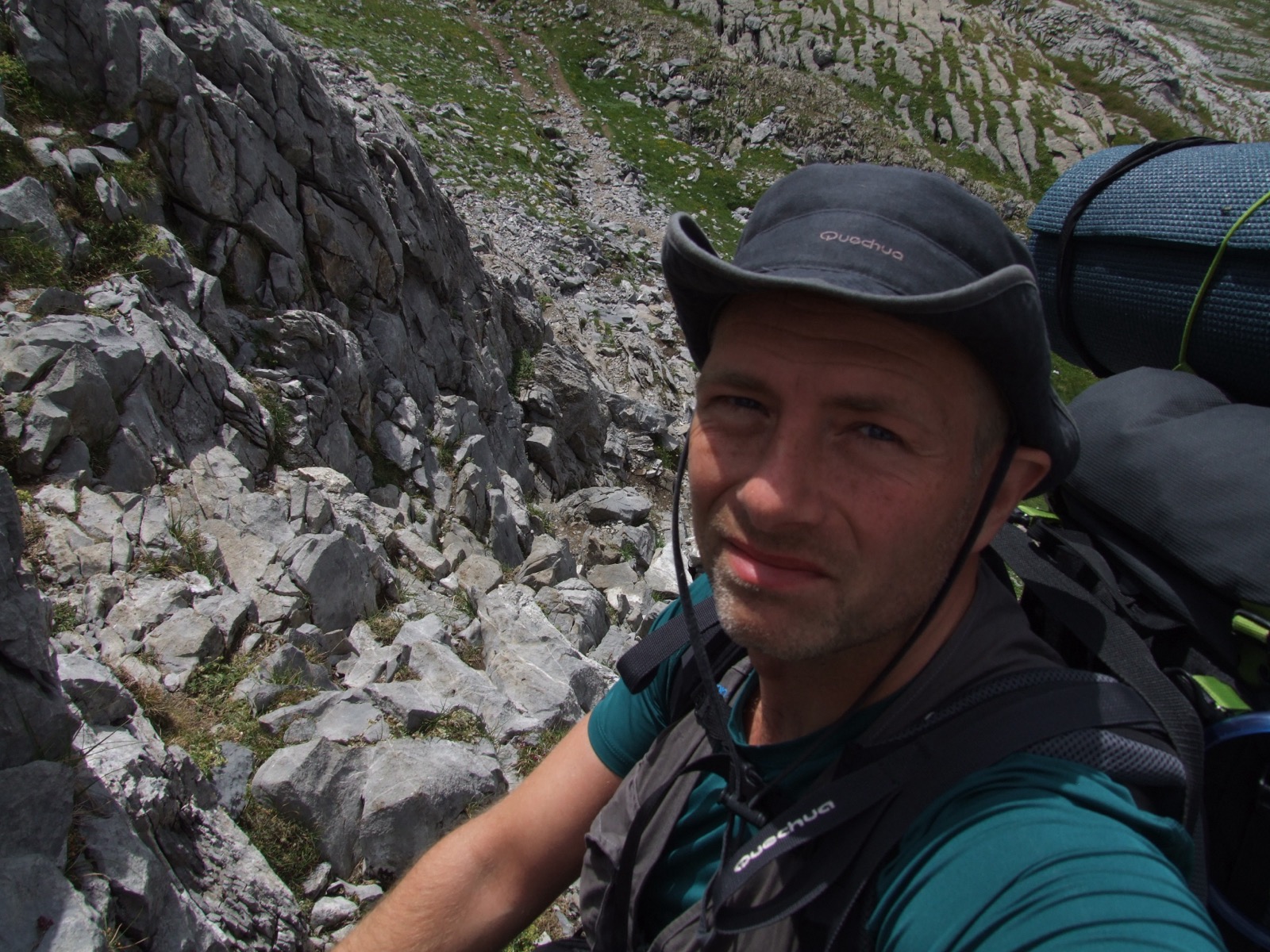
The following morning, the plan was ready for a summit ride to Mount Monte Perdido. It would be exciting to get higher up than ever before as well. There's a certain sense in breaking through mental barriers and stepping a little out of their comfort zone. When I climb a higher mountain, it's one aspect of a summit ride. It is also not known if the weather will allow for a summit climb, that is always another factor. Finding and navigating up a high mountain can also be challenging. Sometimes it's simple and the trail is marked when hiking. But here at Perdido, it wasn't like that. I had my handheld GPS with a route up the mountain that someone shared on the Internet. It was very helpful as a reference to the path that my friend and I took. As usual when I do the top trip, I choose a smaller backpack with what is most necessary. In this case, we opted out of freeze-dried food and gas cookers to instead carry snacks such as dried fruit and energy bars of different kinds for our daily ration. We also managed to fit in a shell jacket, which should ideally be both windproof and waterproof.
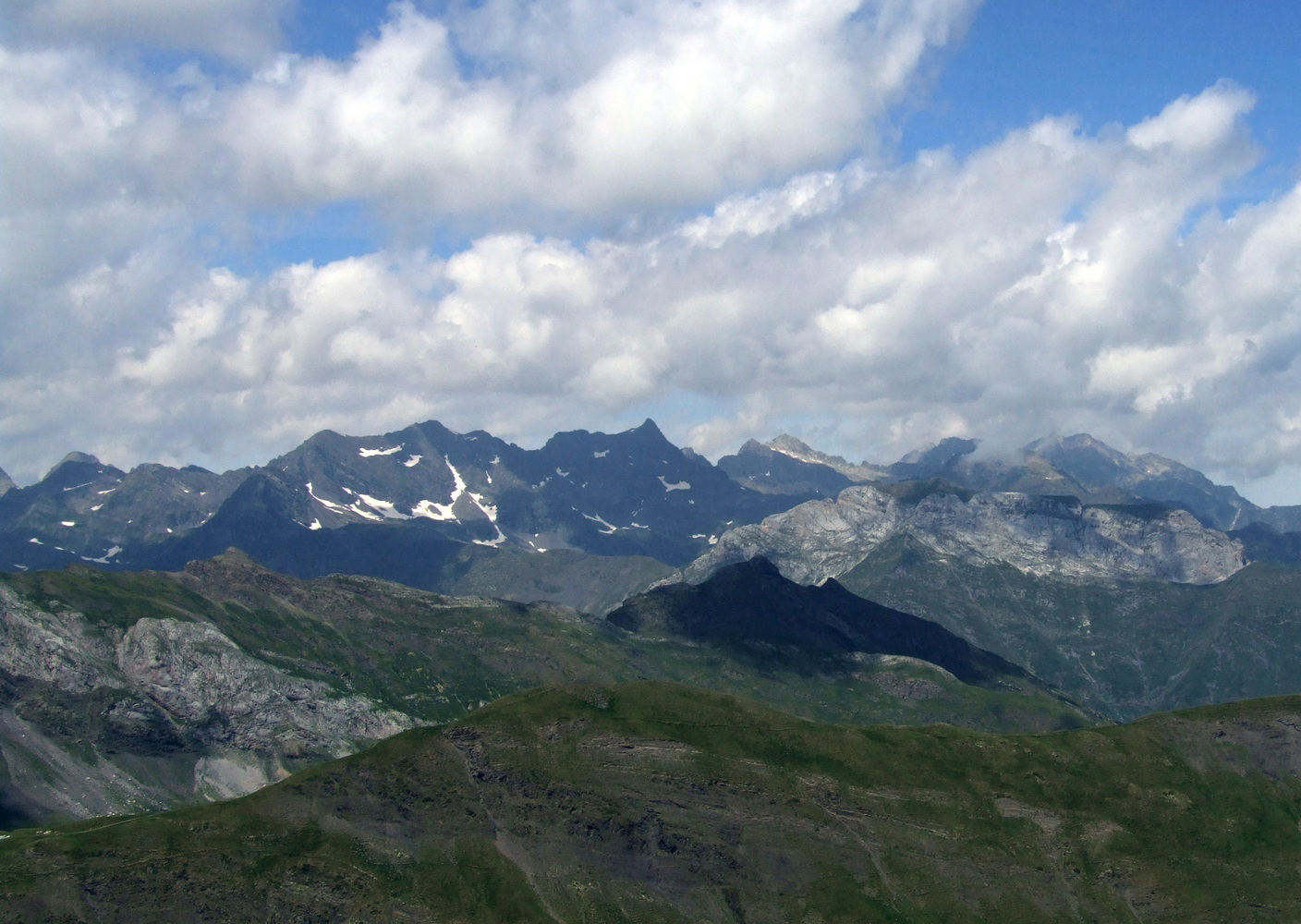
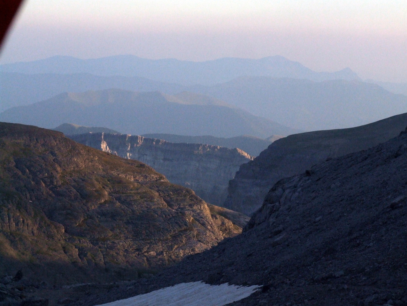
We had a nice morning but a lot of clouds. After breakfast we set off and slowly made our way up the mountainside. When I looked back out over the valley it was very beautiful with the clouds and the sun breaking through here and there casting shadows and rays of light on the opposite side of the valley.
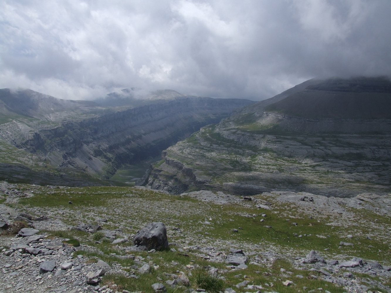

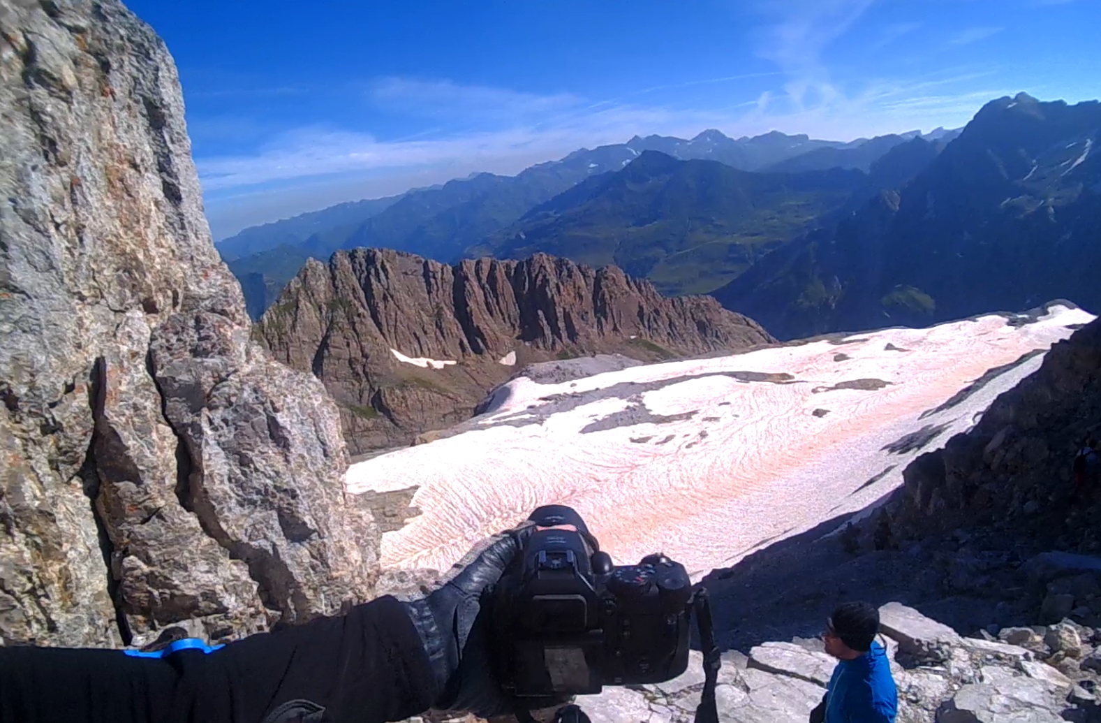
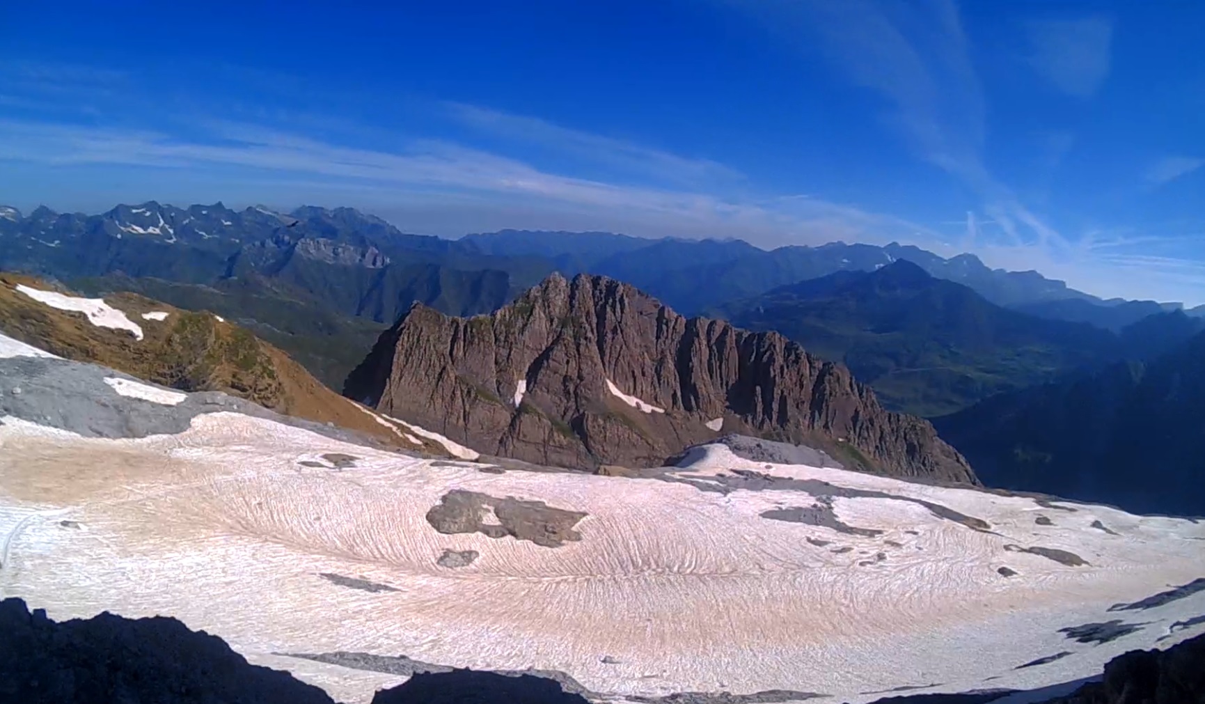
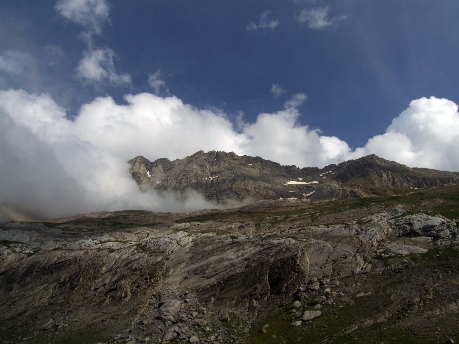
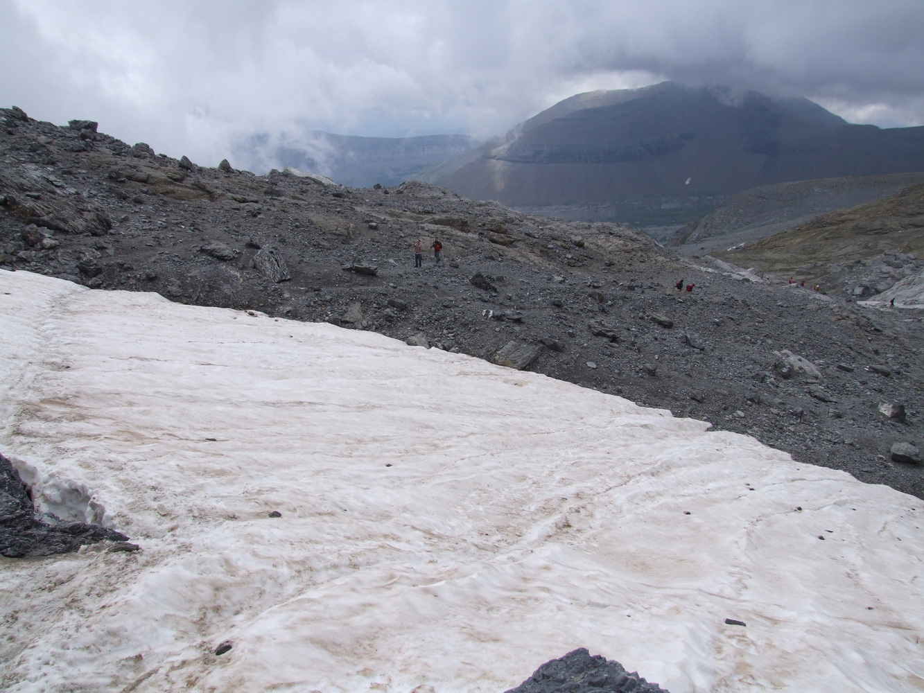
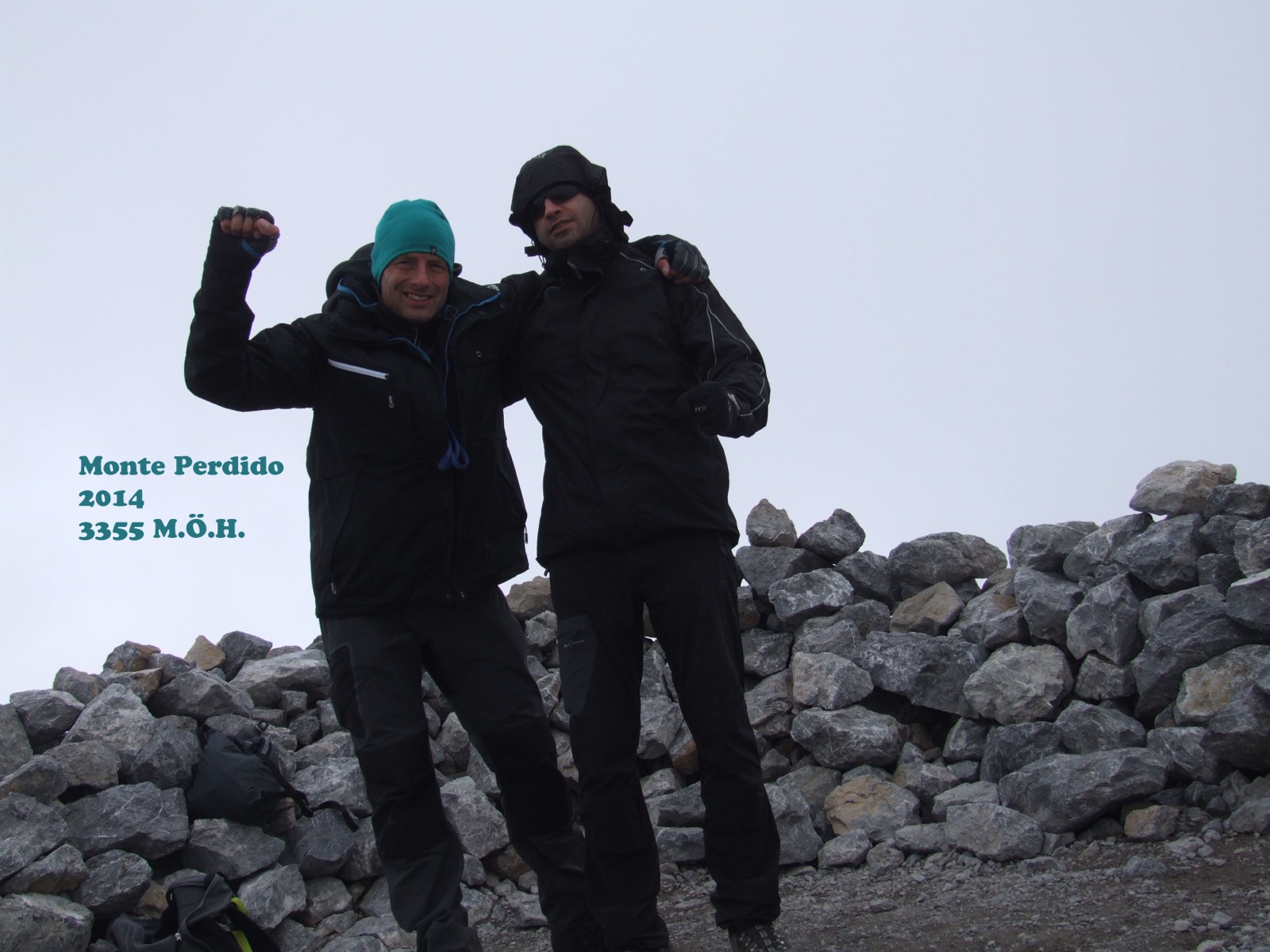
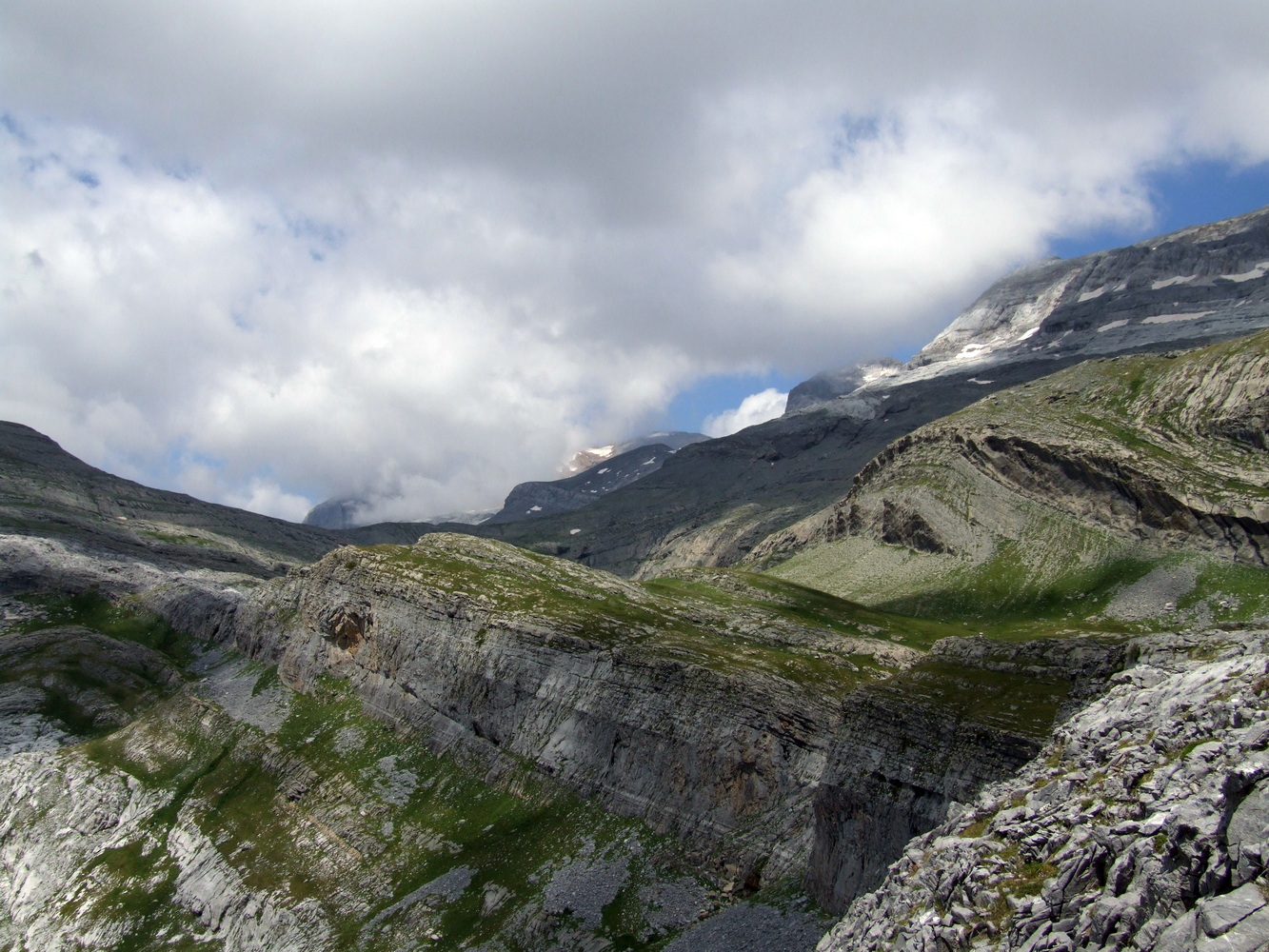
It is still relatively warm and light greenery here at about 2500 m.a.s.h. Not at all what it looks like in the mountains at home. This was already higher than anything I'd experienced before. But eventually the surrounding area became completely barren with no plants. It was easy climbing to get further uphill and although it is not advanced, an injury such as a sprained foot can be very devastating and you should always be focused when climbing mountains. As we got closer to the top, it got colder and finally we were up in patches of snow on the mountain. The clouds were now not only high above our heads, but they sailed around us, completely enveloping us from time to time. I was hoping we would get a view from the top of Perdido but it looked like it was inside among the clouds.
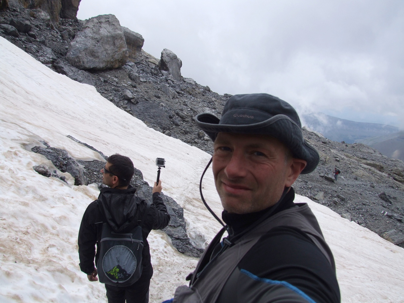

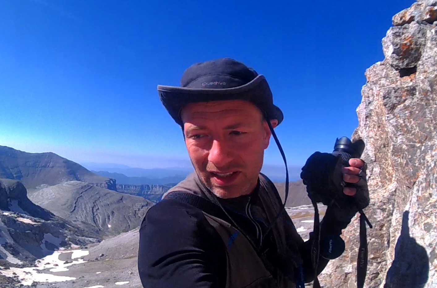
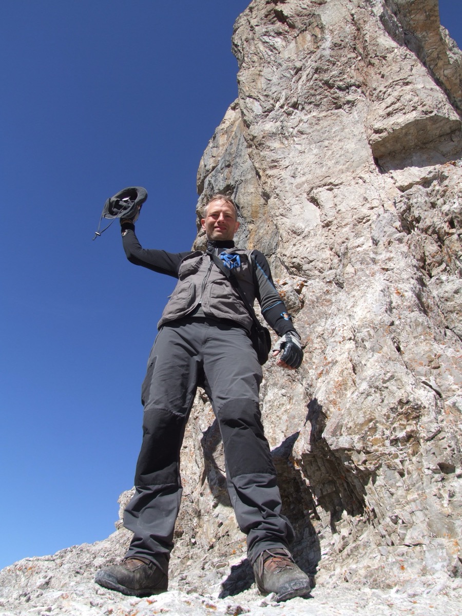
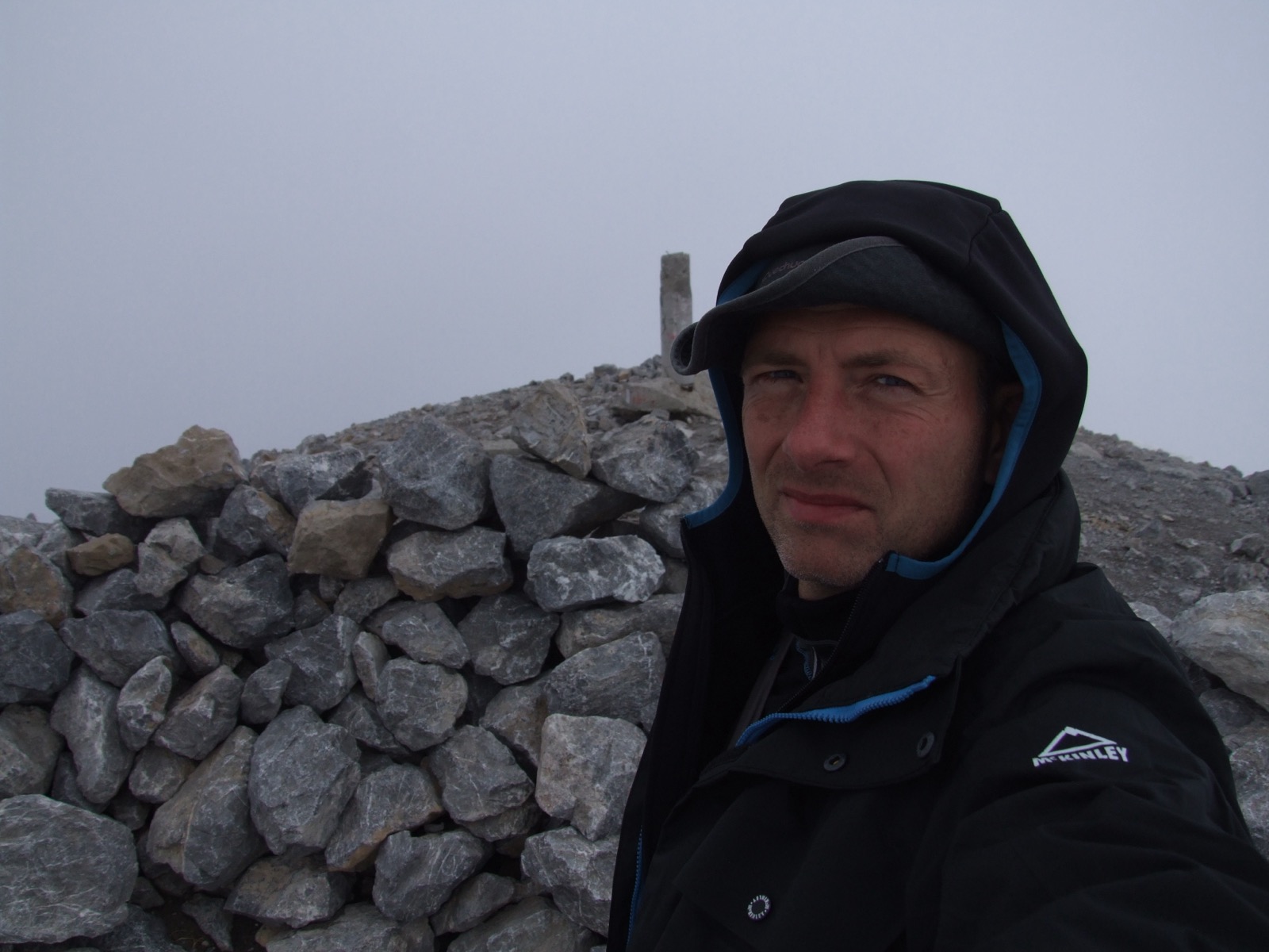
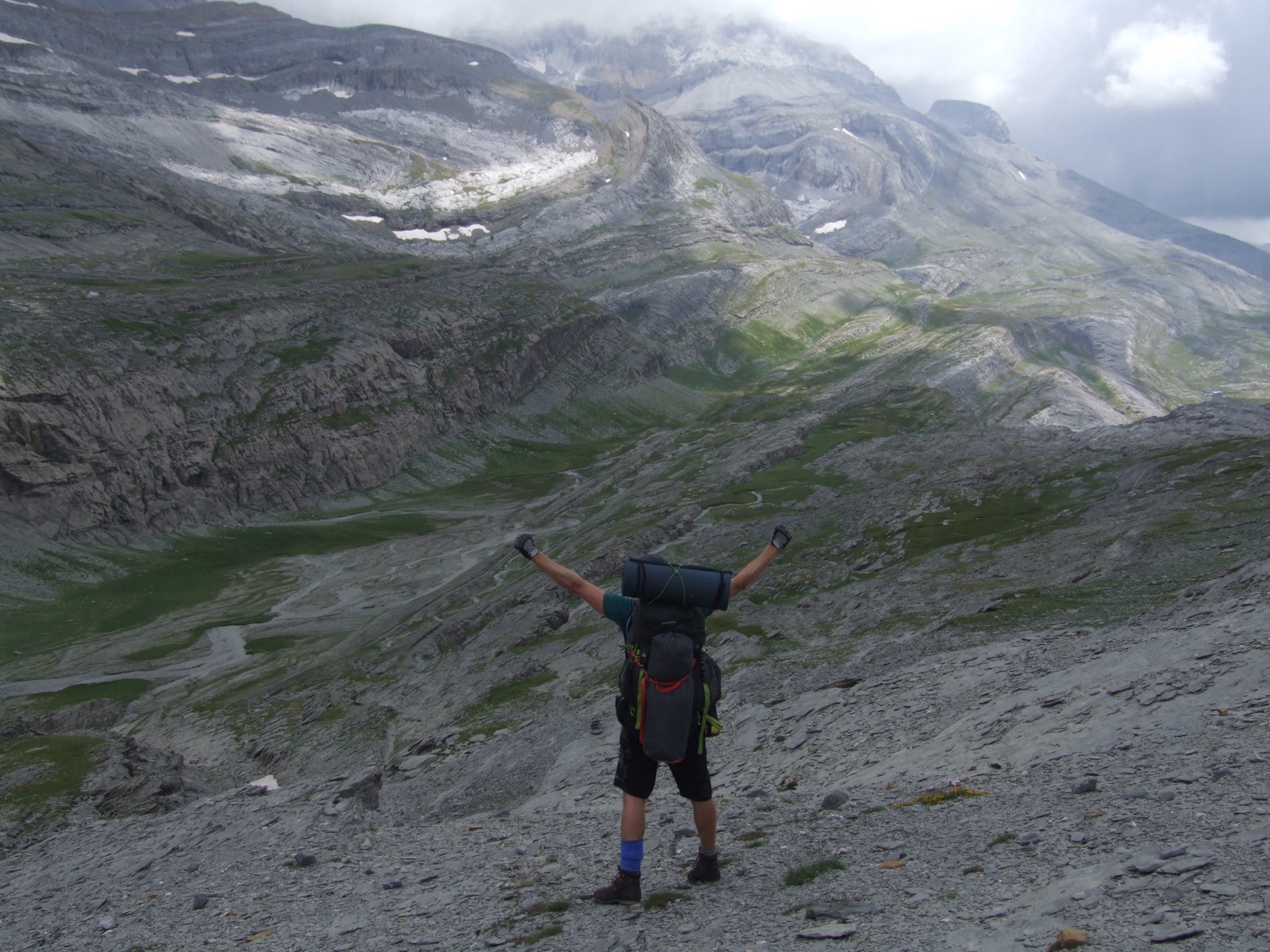
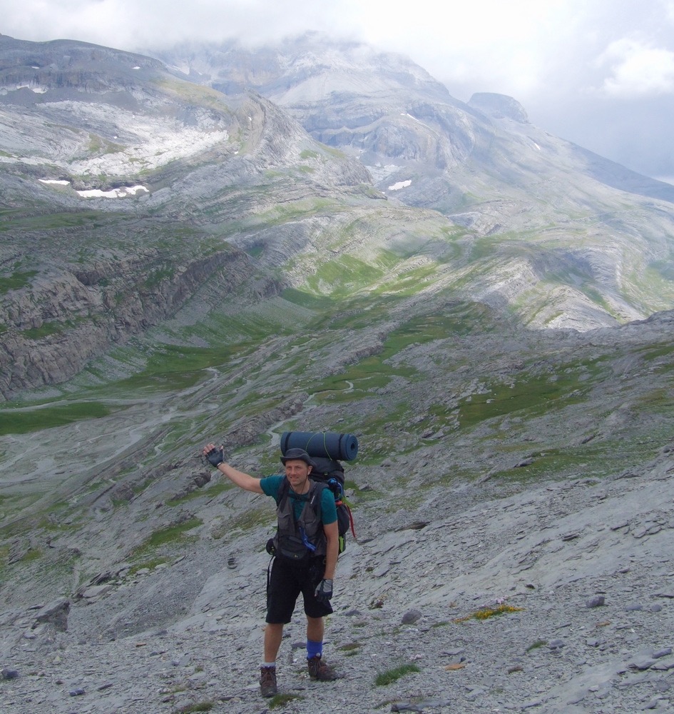
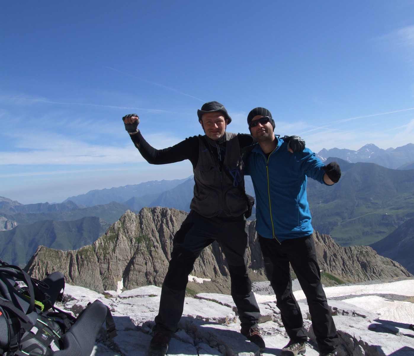
The wind increased and unfortunately we didn't get much visibility when we reached the top, but both me and my friend felt very pleased to have made it here. It was not so technically difficult but still many meters of altitude and sometimes very steep up to the top. It was clearly a nice feeling to stand there at the top and celebrate our achievement together. We stayed at the top for a while to see if the clouds would clear up and give us a clear view but unfortunately we didn't have that luck with us. However, the view during the descent to our camp site at Goriz became very beautiful. We had a lovely evening where we caught up after a long day's ascent. It was going to be a challenging day for us even tomorrow so we needed to eat and get good sleep to recharge. Tomorrow it was full again and then we headed further into the mountain massif.

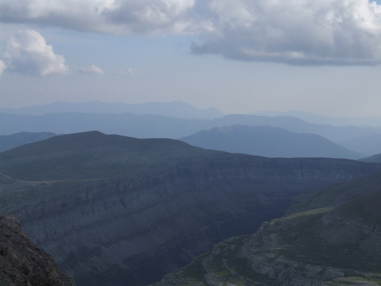
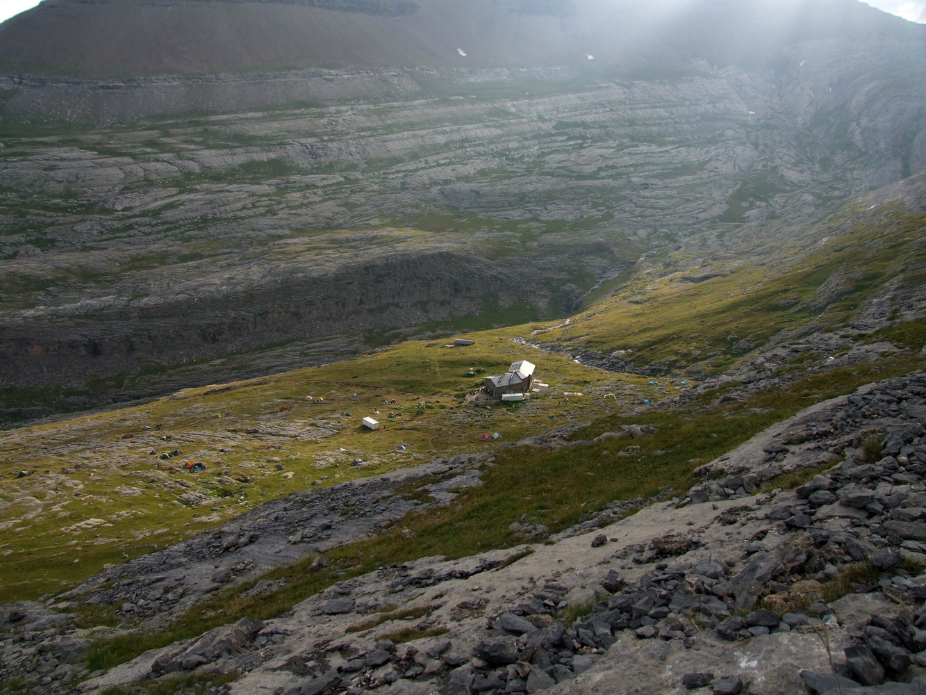
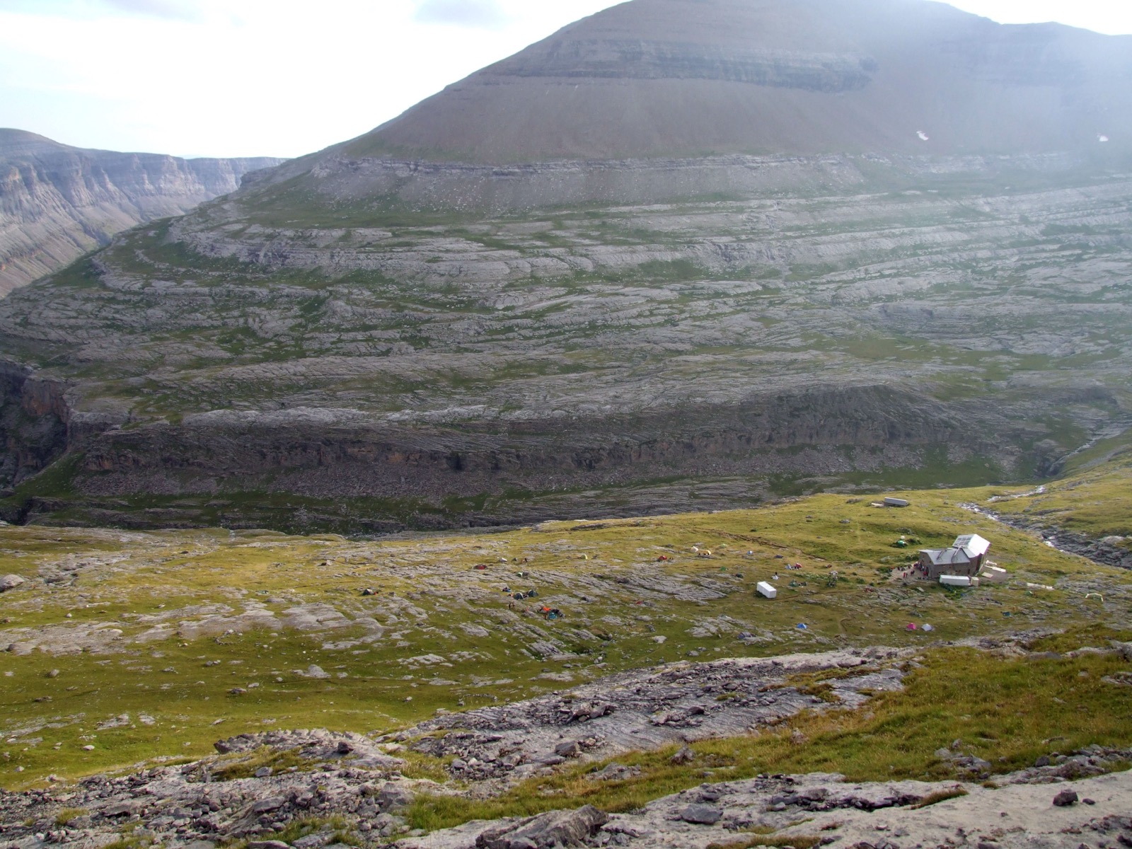
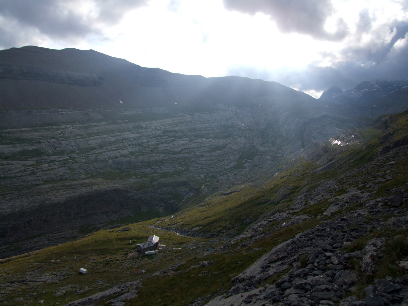
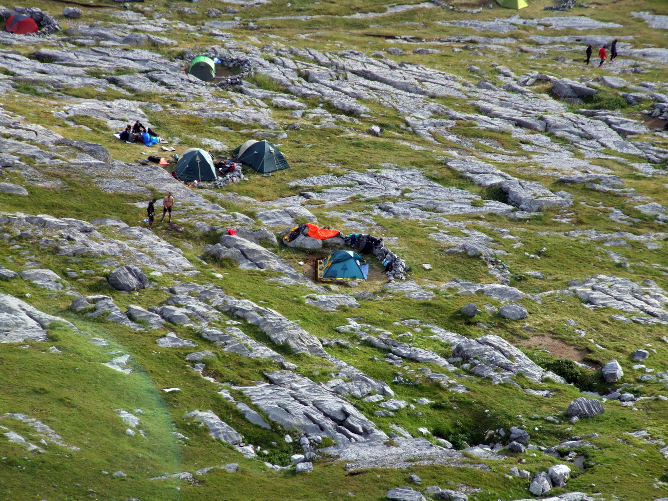
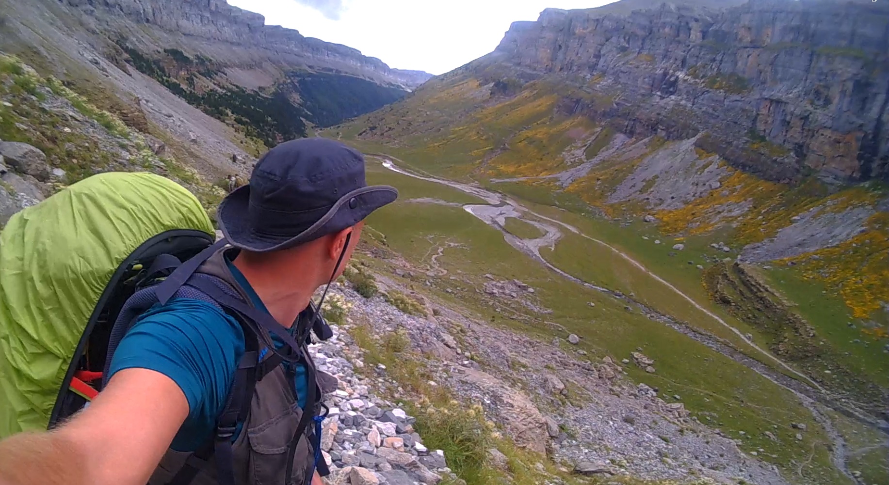
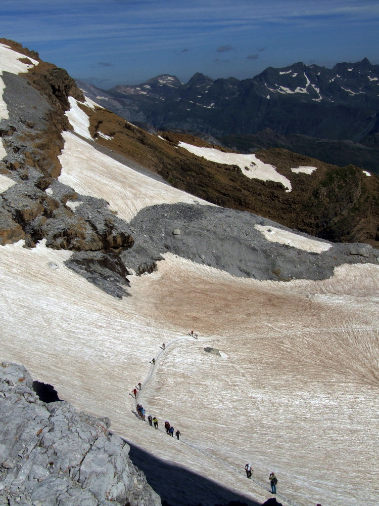
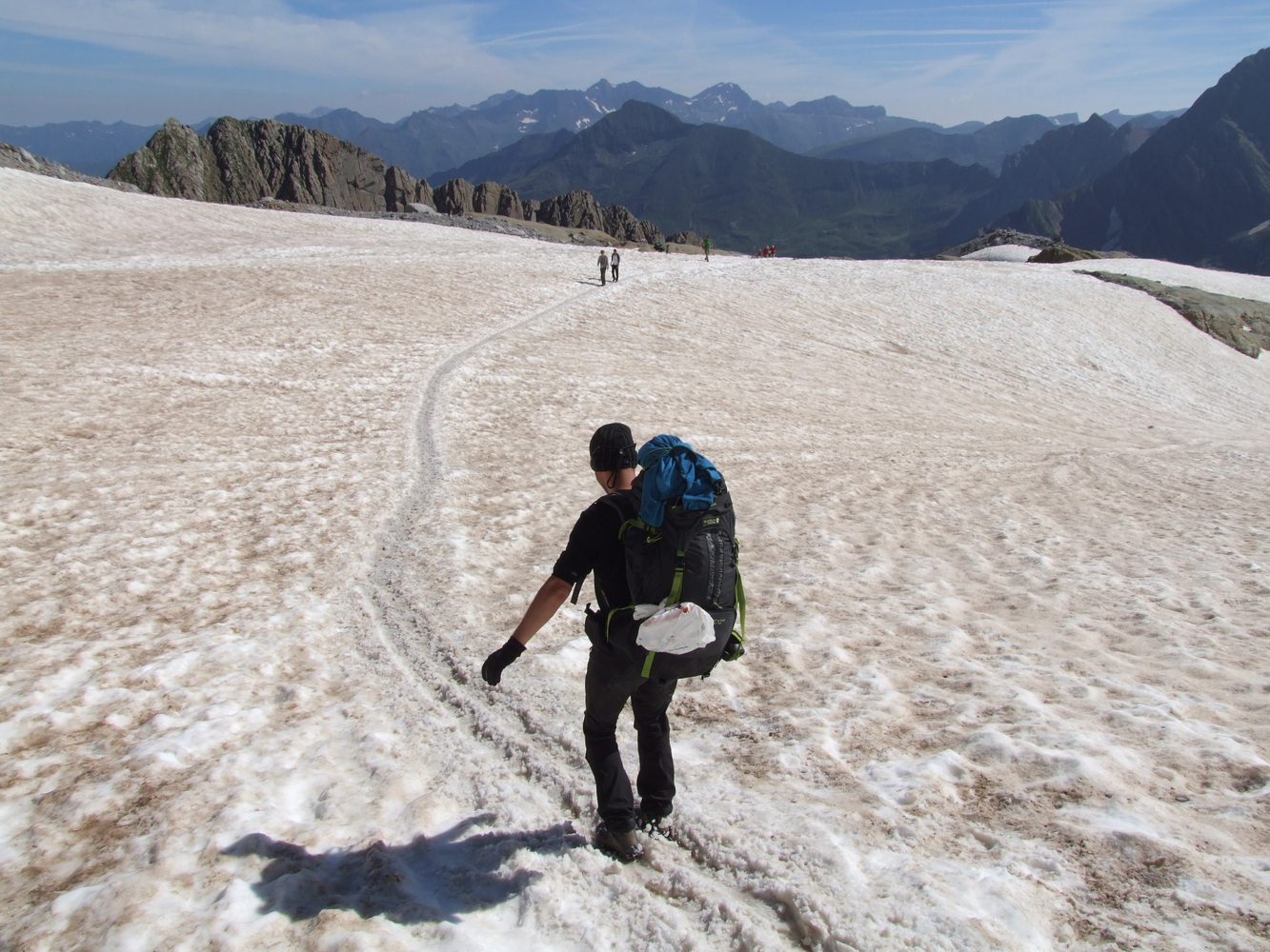
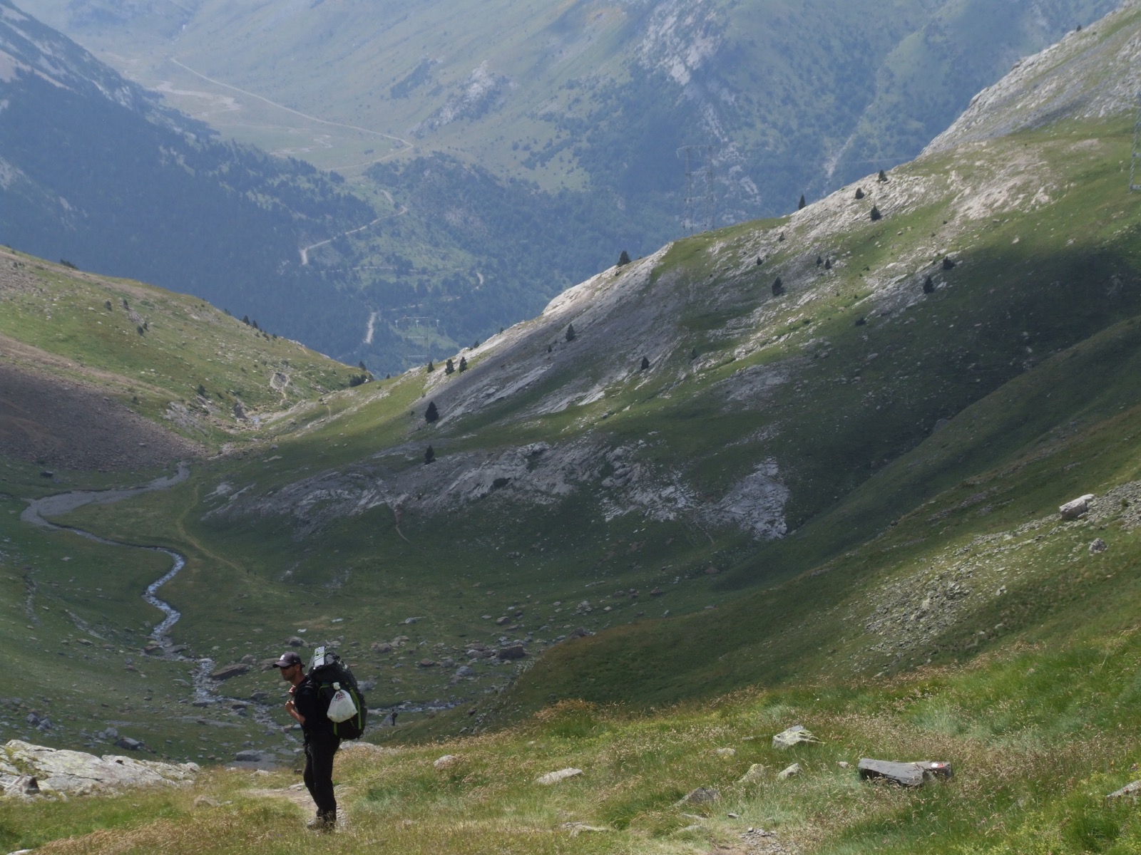
When we packed up the tent after breakfast and prepared for the next stage the following morning, it was sunny and the temperature rose from warm to sultry already in the morning hours. This is despite the fact that we were at an altitude of over 2000 meters here in the camp at Goriz. It was going to be a sweaty day with full packing and the idea was to get around the plateau into the next valley where we were expecting to see the mighty “portal” between Spain and France. Maybe we would even make it over to the French side, but if nothing else, camp nearby. It would be easy climb and about 10km to the pass over the mountains. But from here it was not a clear line but there were alternatives and some unknown problems along the way it would turn out. I was a bit stiff after yesterday's summit but otherwise I felt strong. My friend felt a slight pain in his stomach and he suspected it was due to coffee and the freeze-dried food. But we still had a lot of snacks like dried fruit and energy bars with high calorie content so we were not worried but left Goriz behind and from here on there were far fewer people in our direction. Now it would be exciting to leave the tourist-dense part and get out into a valley where it felt even more like a wilderness.
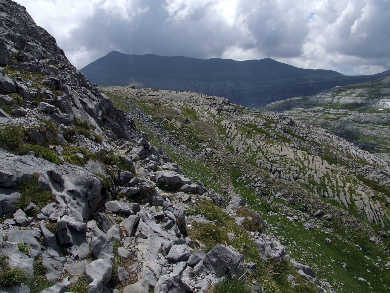
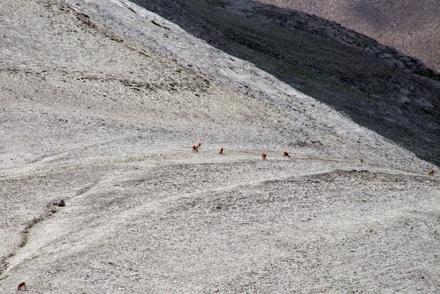
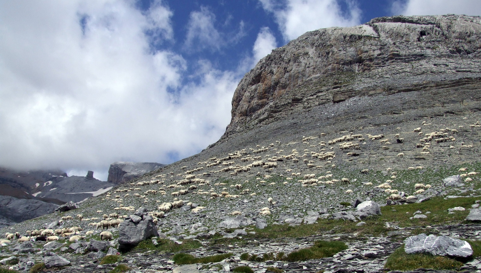
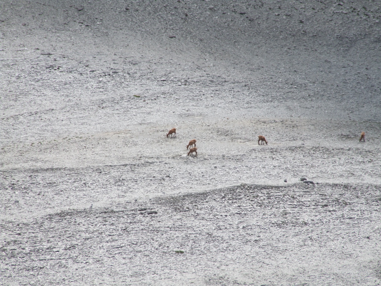
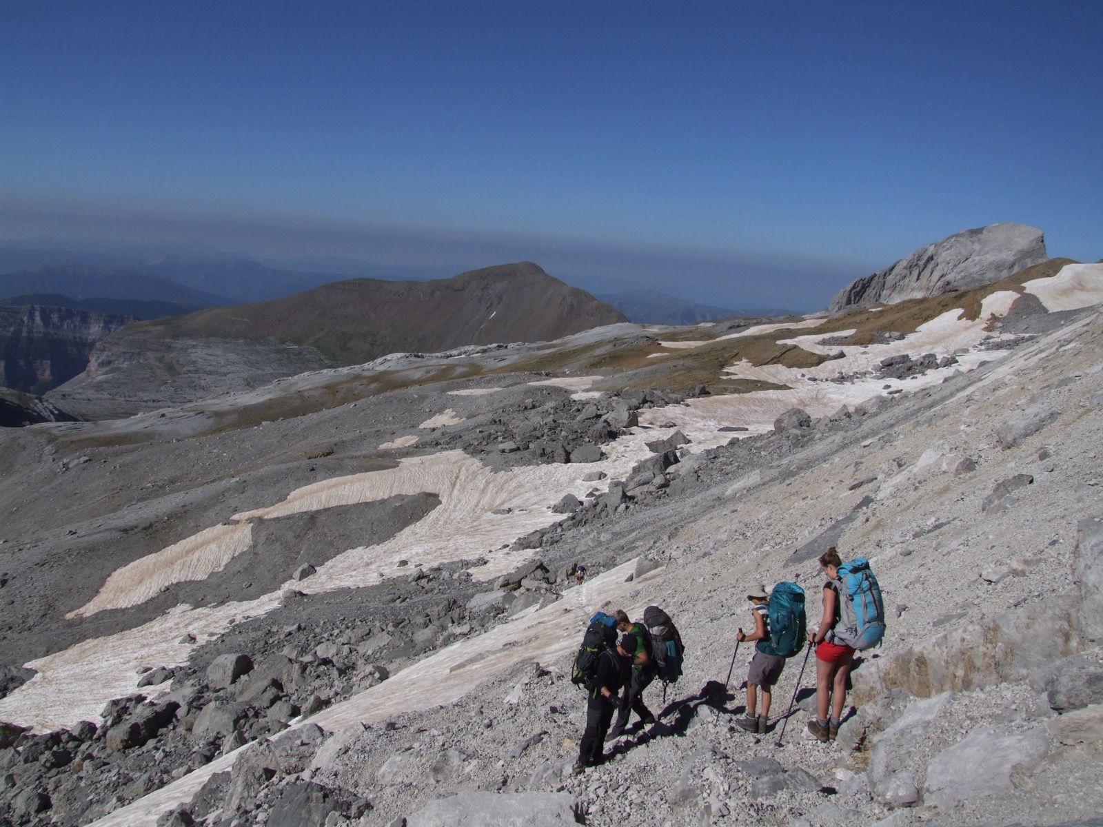
There was a new valley below us and our own passage forward became steeper and narrower the higher and further in we got. The landscape also gradually changed, it became less and less green vegetation and increasingly drier. We now took the opportunity to fill the bottles with water at the next mountain stream because it was unclear how the availability of water would be in the future. I looked from time to time out into the valley below us and at one point I discovered some deer on the mountain opposite. With my camera's zoom, I could see that they seemed to graze even though it was a very barren rock landscape, but at least something green seemed to find where they went. A little later, we were both surprised again when a large flock of sheep was at a height with us where we would swing around the next crest. We did not see any shepherd and did not understand why they were here where there was hardly any grazing but there was certainly someone who cared for them nearby.
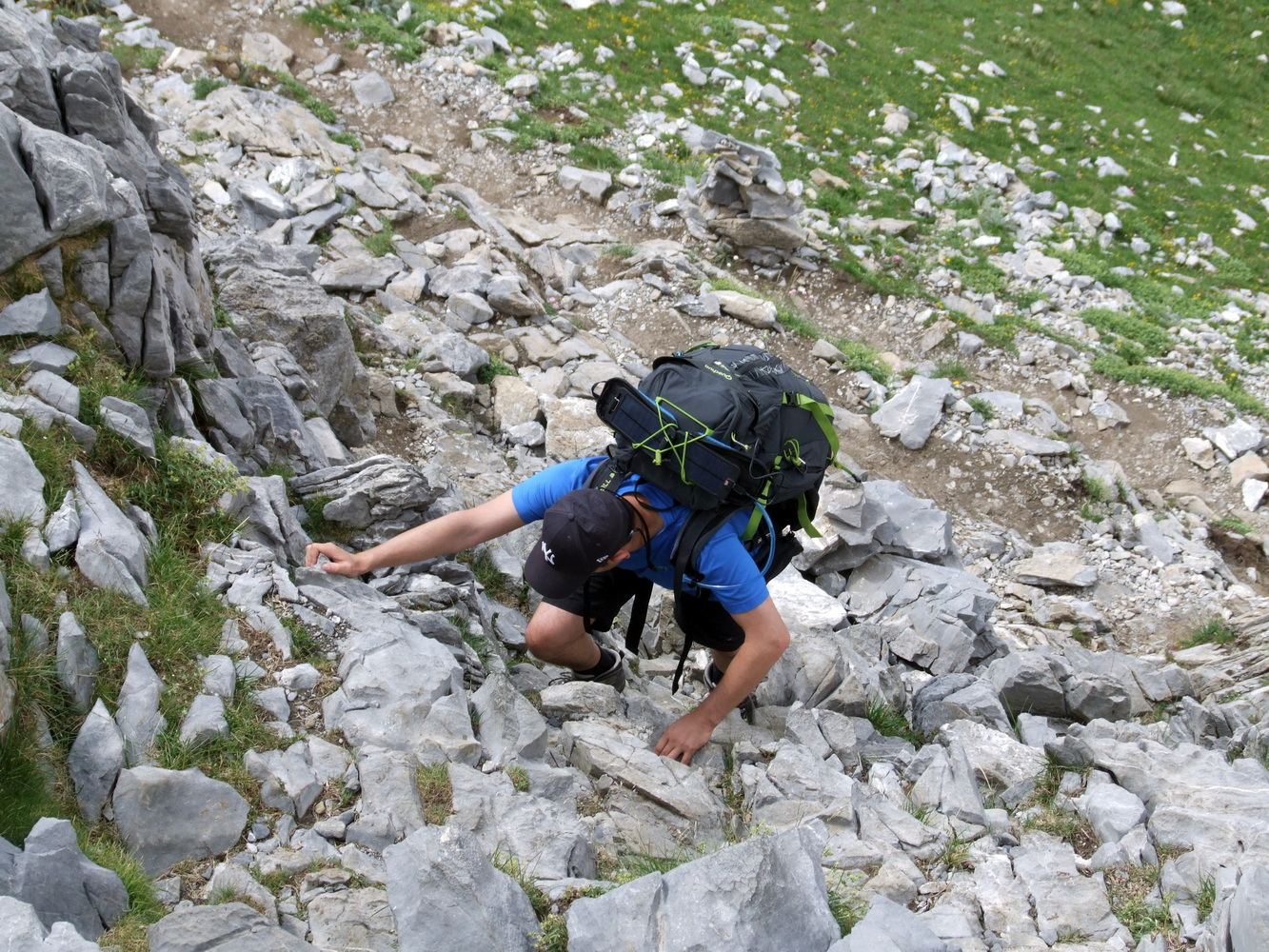
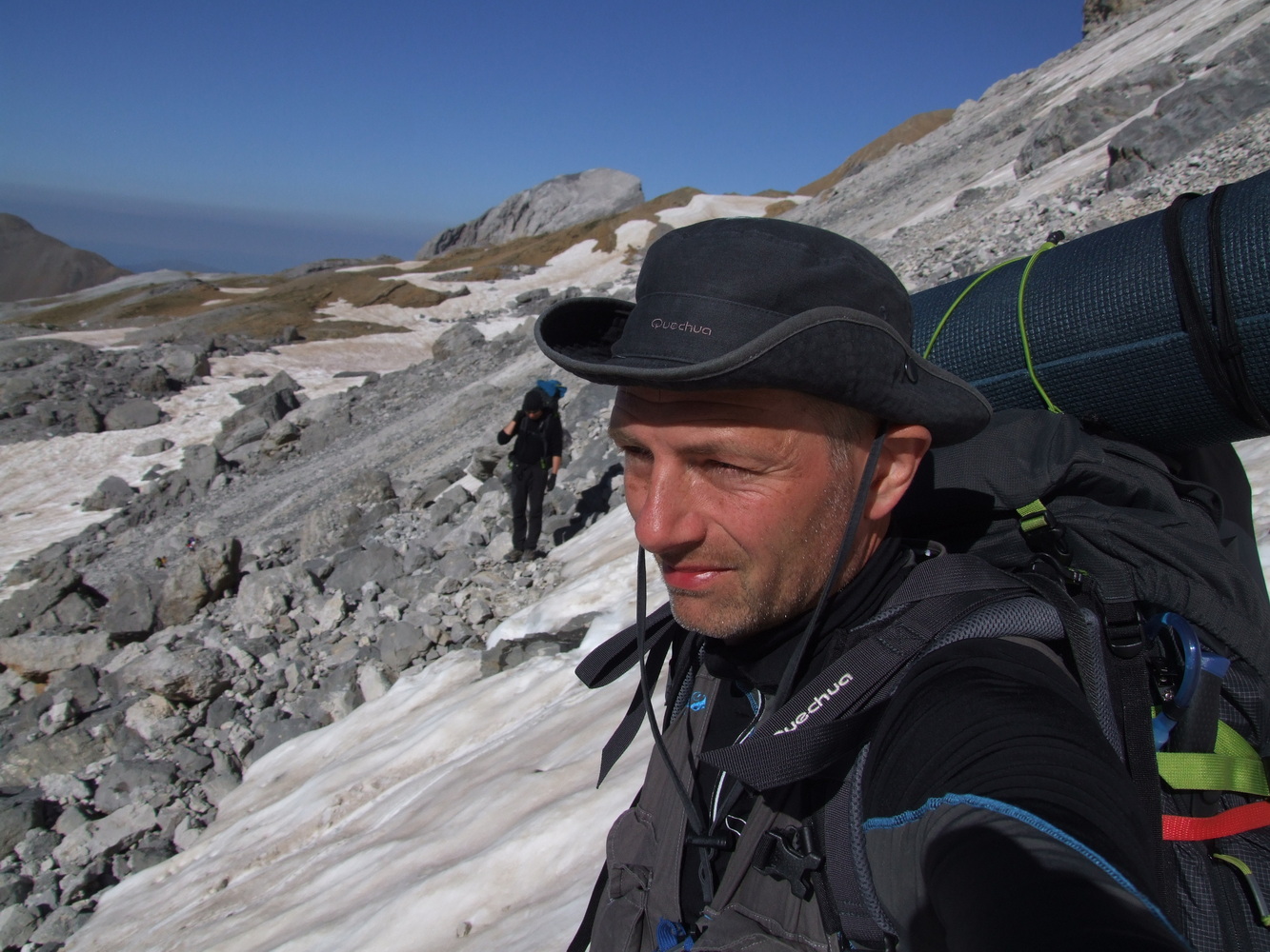
The slope we had in front of us a little further on looked difficult to climb and the mountain had begun to have large boulders lying like giant dice along the side of the mountain. We were slowly moving up and forward in the terrain. Now it became increasingly difficult to follow our route and only a few meters out sideways from the GPS track I had was able to distinguish over ten meters in height. It was finally time for a much needed lunch break as we had been climbing with heavy backpacks for a long time. So when we found some shade among the boulders, we settled down and began to boil water. My friend wasn't too happy about eating those freeze-dried meals, since his stomach was acting up, but he gritted his teeth and ate them anyway.
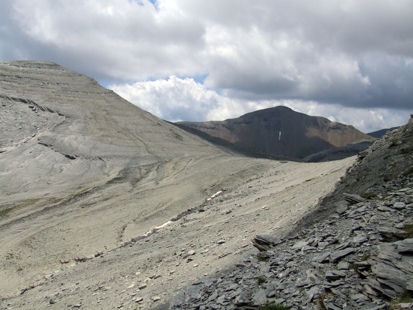
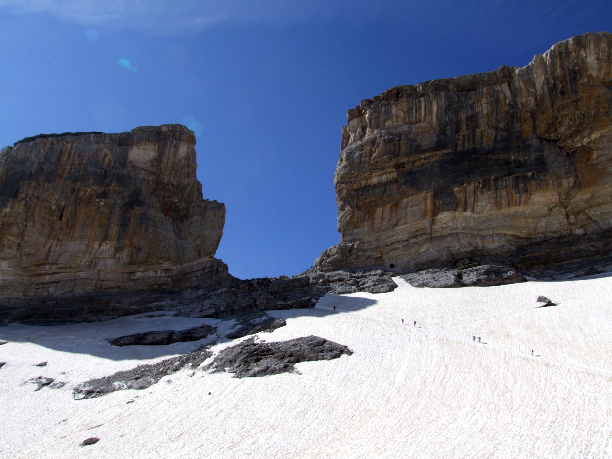
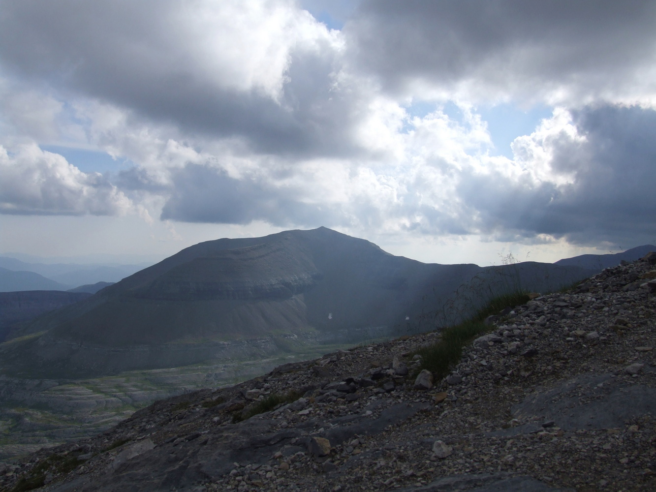
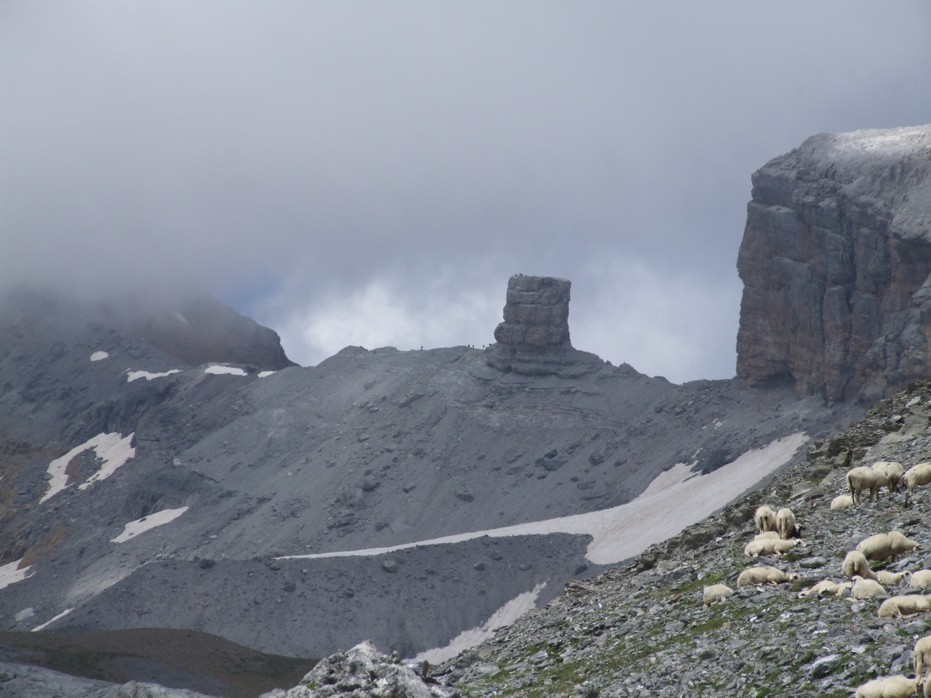
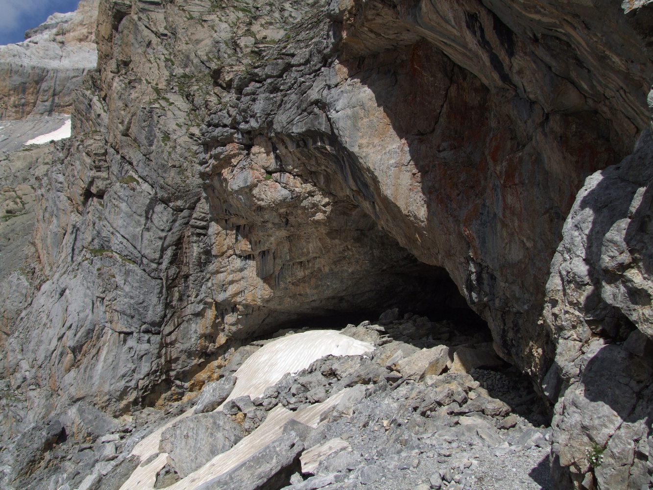
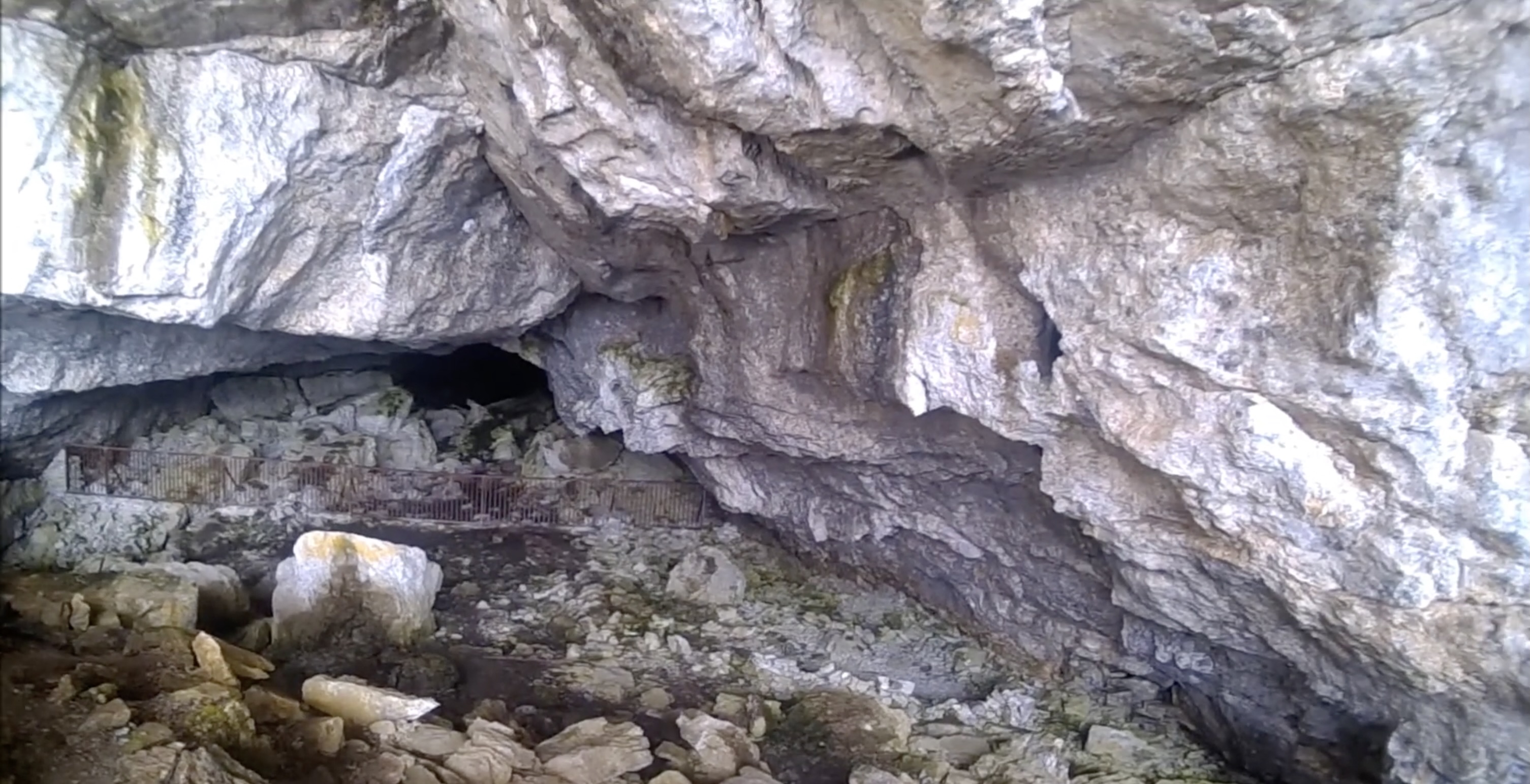
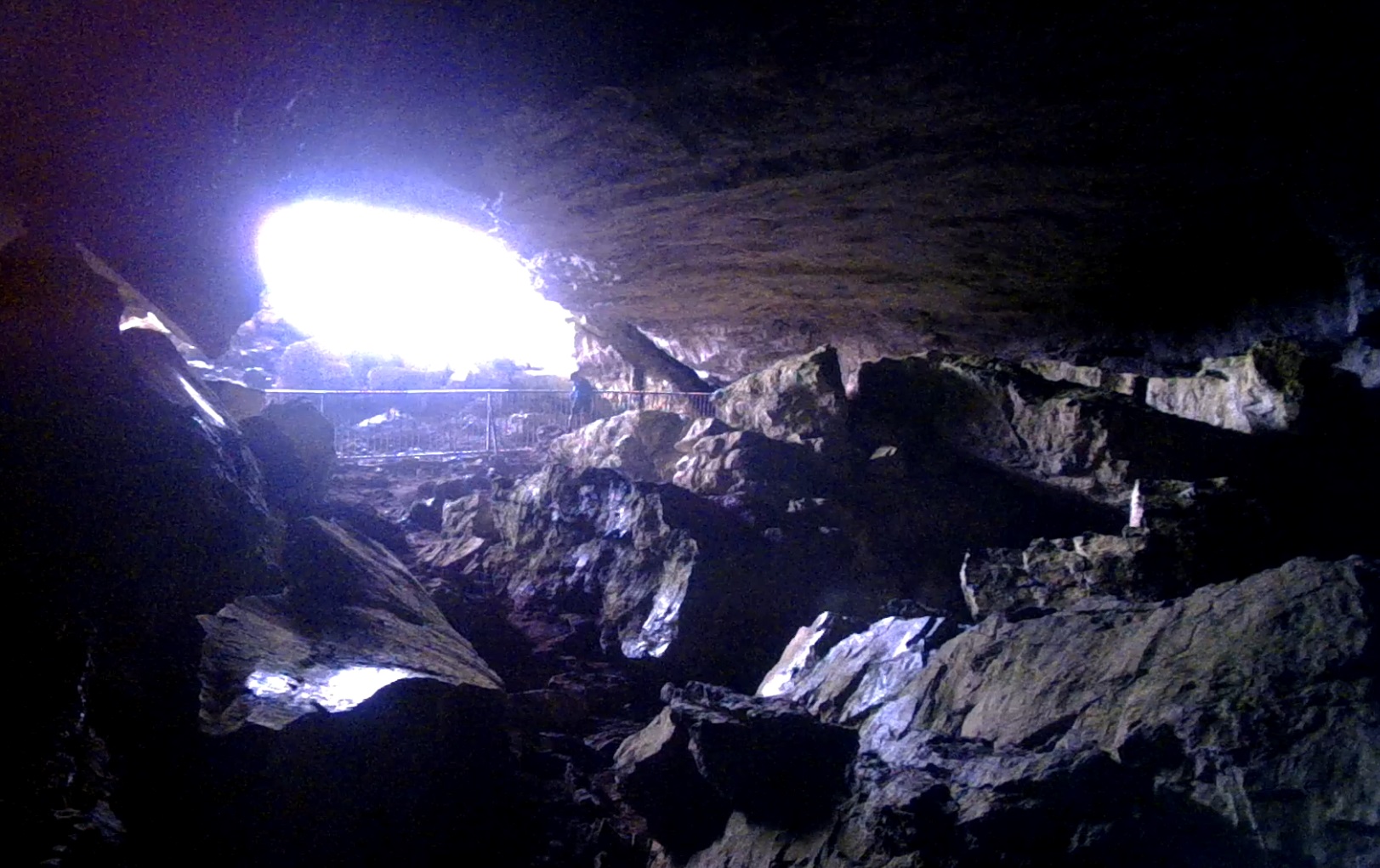
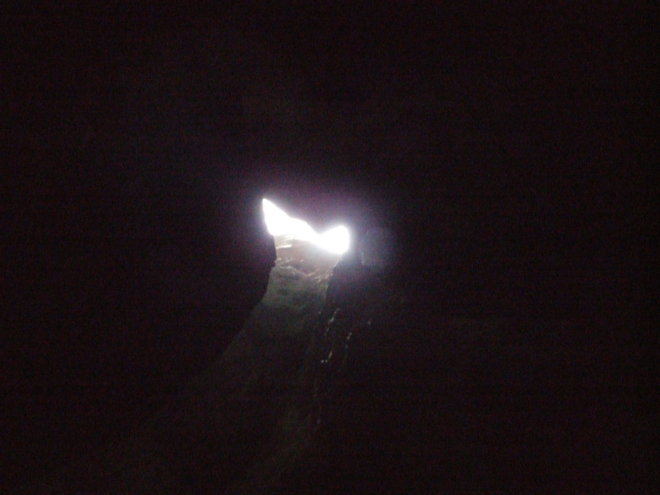
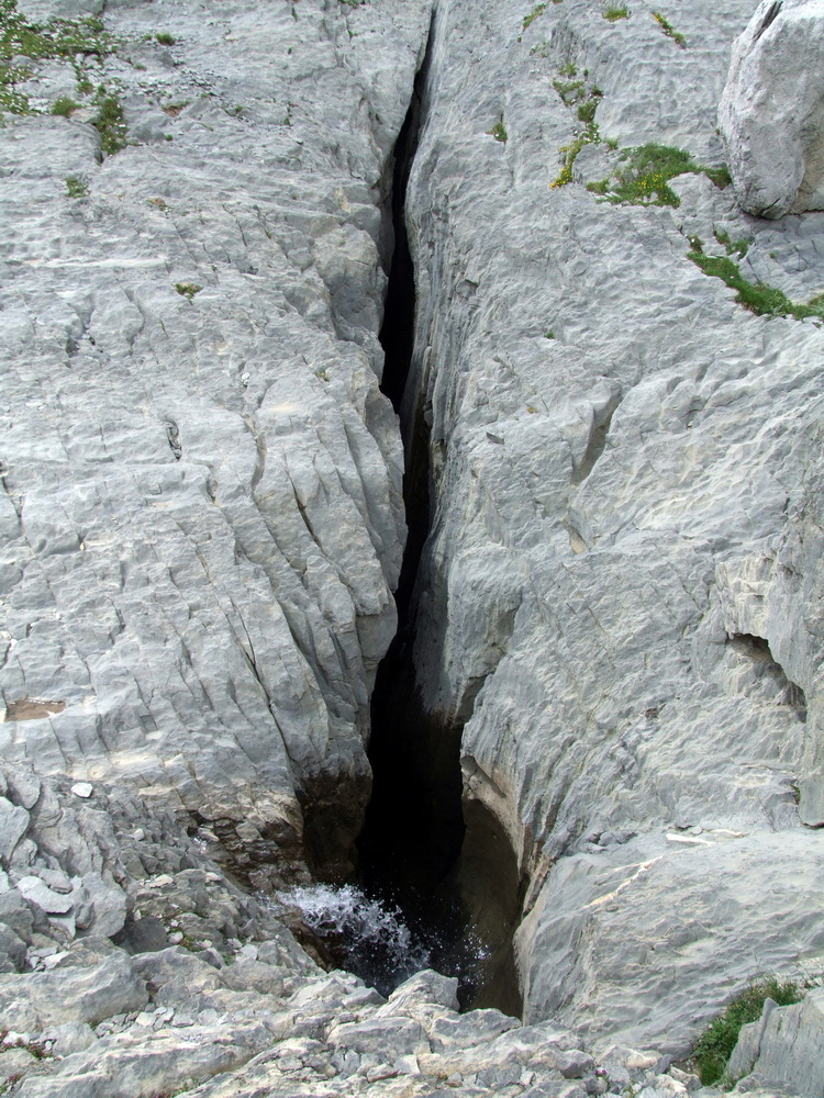
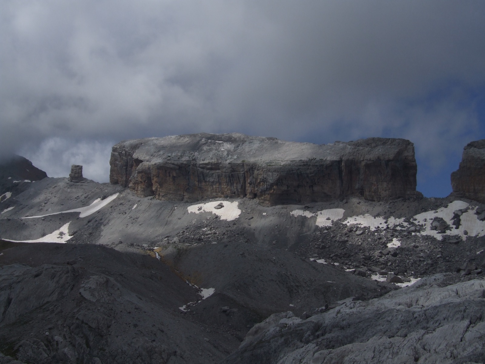
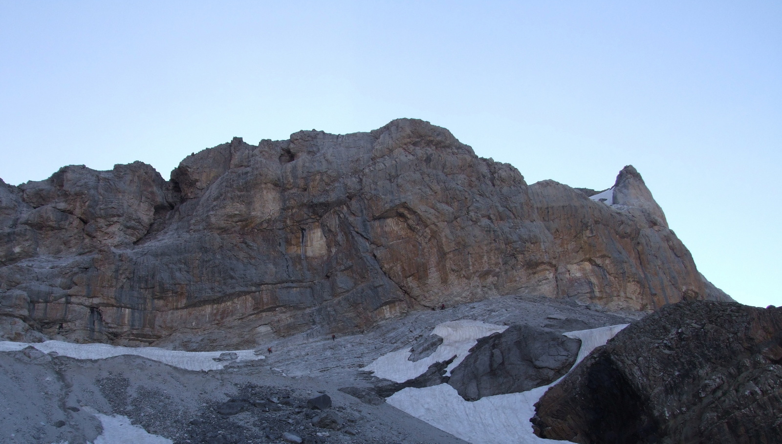
Soon we reached a crest and could at least see the mountain pass over to France on the horizon. We marveled at the mighty rock formation far away and at the same time pondered how to get there. I could see little dots like silhouettes against the sky in my camera over there in the pass. It was very rugged and difficult to see which way to take among rocks and giant boulders but we climbed further and all of a sudden we arrived at what seemed to be a giant cave. From here, the way forward was very unclear so we took a break. We took off our backpacks and examined the cave a little closer. The cave had a fence about 50 meters in that we climbed over. With headlamp on we could see reasonably but it was very uneven inside the cave. And about 100 meters in, we could see ice from an opening in the ceiling like a column of ice spreading across the floor. Some light came in via the hole where the ice started. As we got closer, it looked almost unreal, a giant icicle from the roof of the cave. We did not go in any further as it was dark and slippery and in the light from the headlamp it was impossible to see how much deeper the cave really was. We had other things to think about now, like finding our way forward.
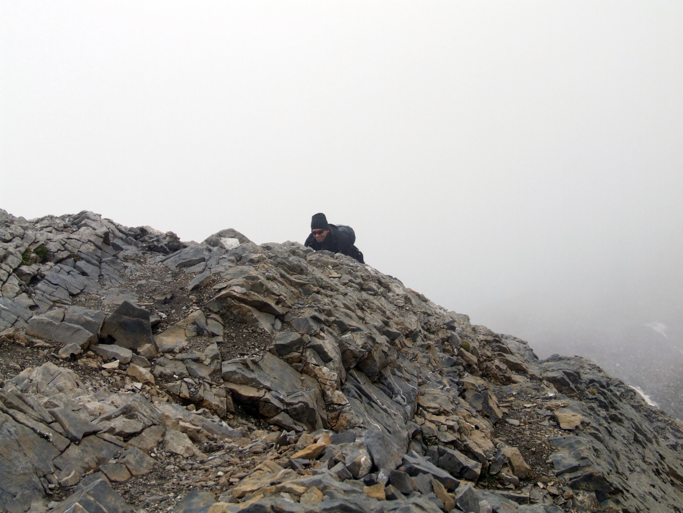
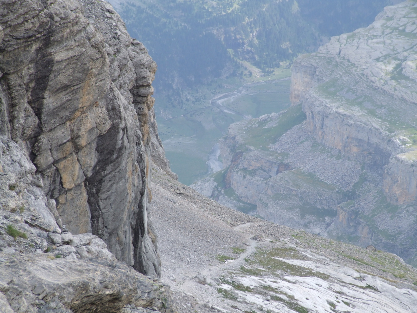
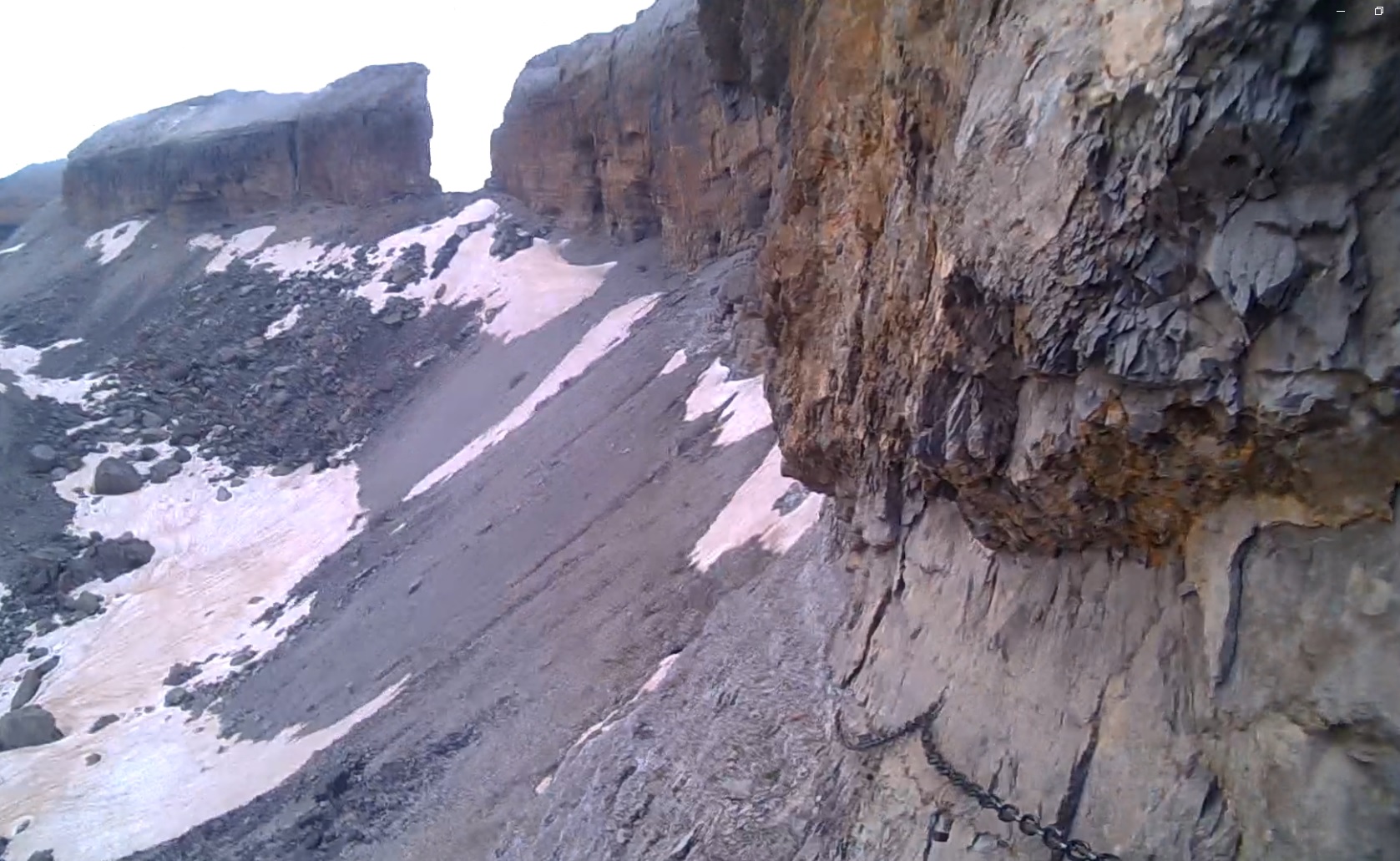
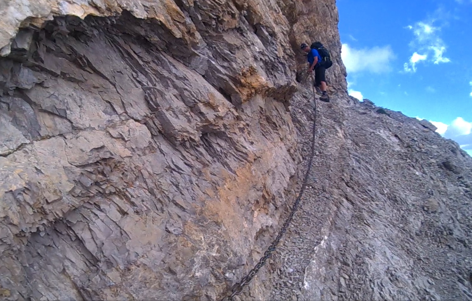
After an exciting tour of the cave, it was time to look further along the mountainside and the following passage was anything but easy. We had arrived at a very steep section of the trail where, according to the map, there would be a traverse with chains bolted into the mountainside to hold on while traversing along a very narrow section with a steep precipice below. The alternative was to go several hundred meters down the valley and then climb back up beyond this part where it looked less risky. When going with heavier packing, I always try to maintain the height as much as possible to avoid too much climbing up and down that drains me both mentally and physically. The problem with this traverse was that it was very steep but also that we could not see it in its entirety from the side where we were now standing.
It could not be seen from here that it also disappeared into remnant snow that blocked the chains behind the next crest further ahead. Later I would see that other hikers were getting in trouble here as well. This became potentially dangerous and my friend who is not a sport climber like myself, became more stressed about how to get out of this as it was very difficult to turn back and climb up the chain again. We decided to lower our backpacks down the cliff first, where they could slide a bit down the gravel, and then we could carefully slide down the slope ourselves a little more easily before it turned into an almost vertical drop.
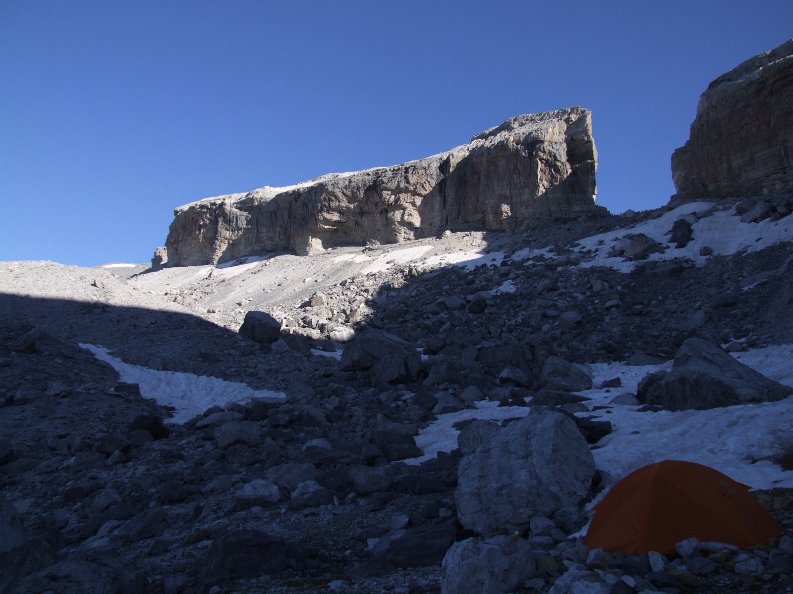
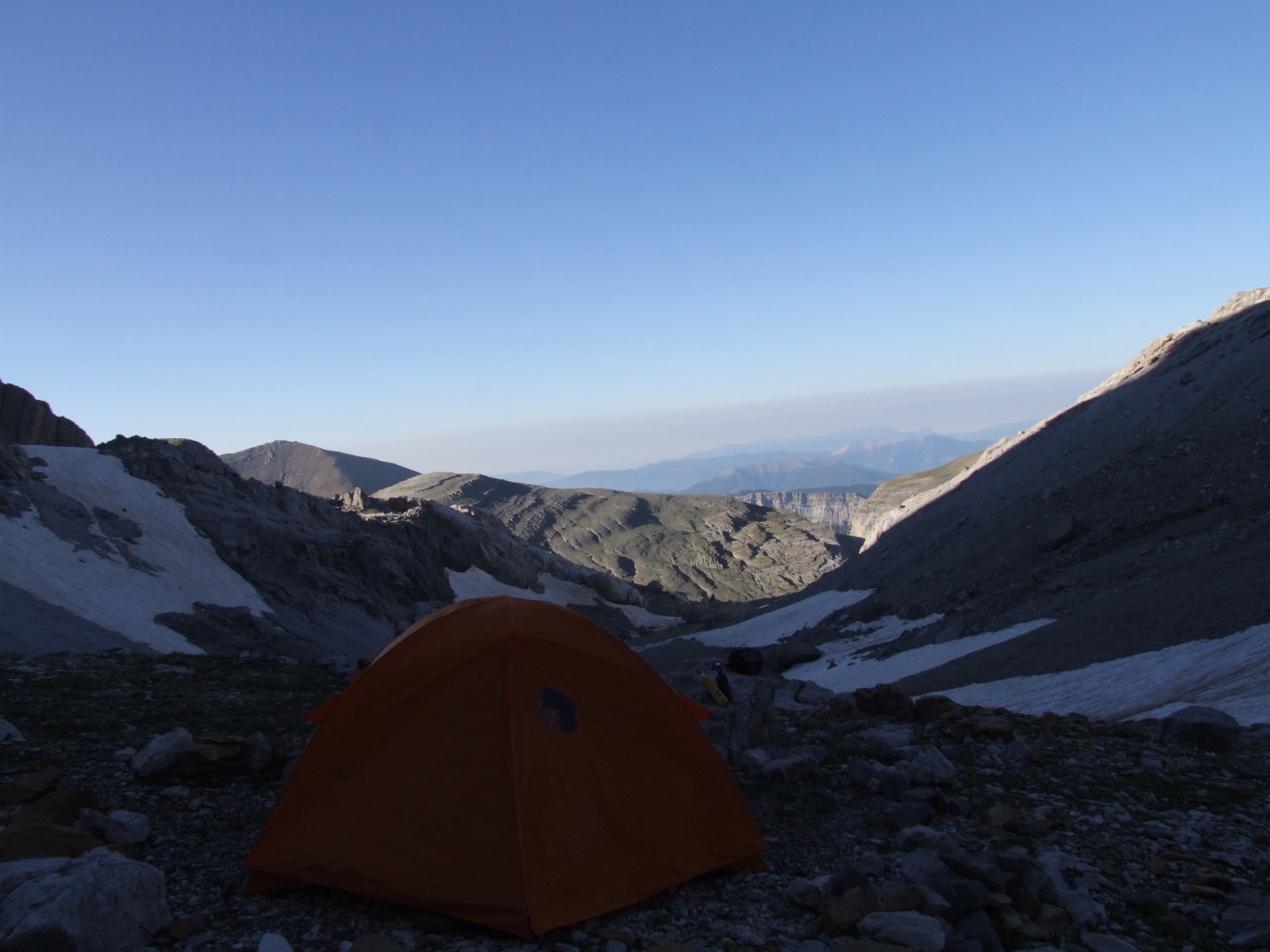
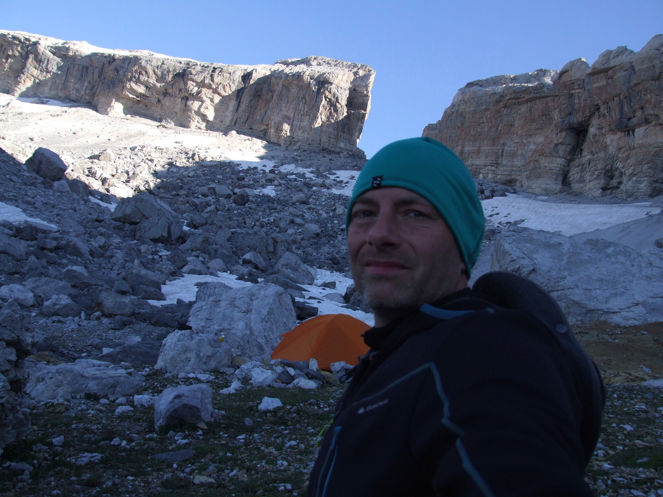
The solution was to lose a few hundred meters of altitude when we went down to the bottom of the valley, which of course was better than getting stuck or falling along the intended path. After that effort, we were perfectly content to find a tent site for the evening and prepare to take the steep climb up to the mountain pass the next day instead. Down here in the valley it quickly got cold and we got ready to sleep in the tent under a starry sky after a long and adventurous day.
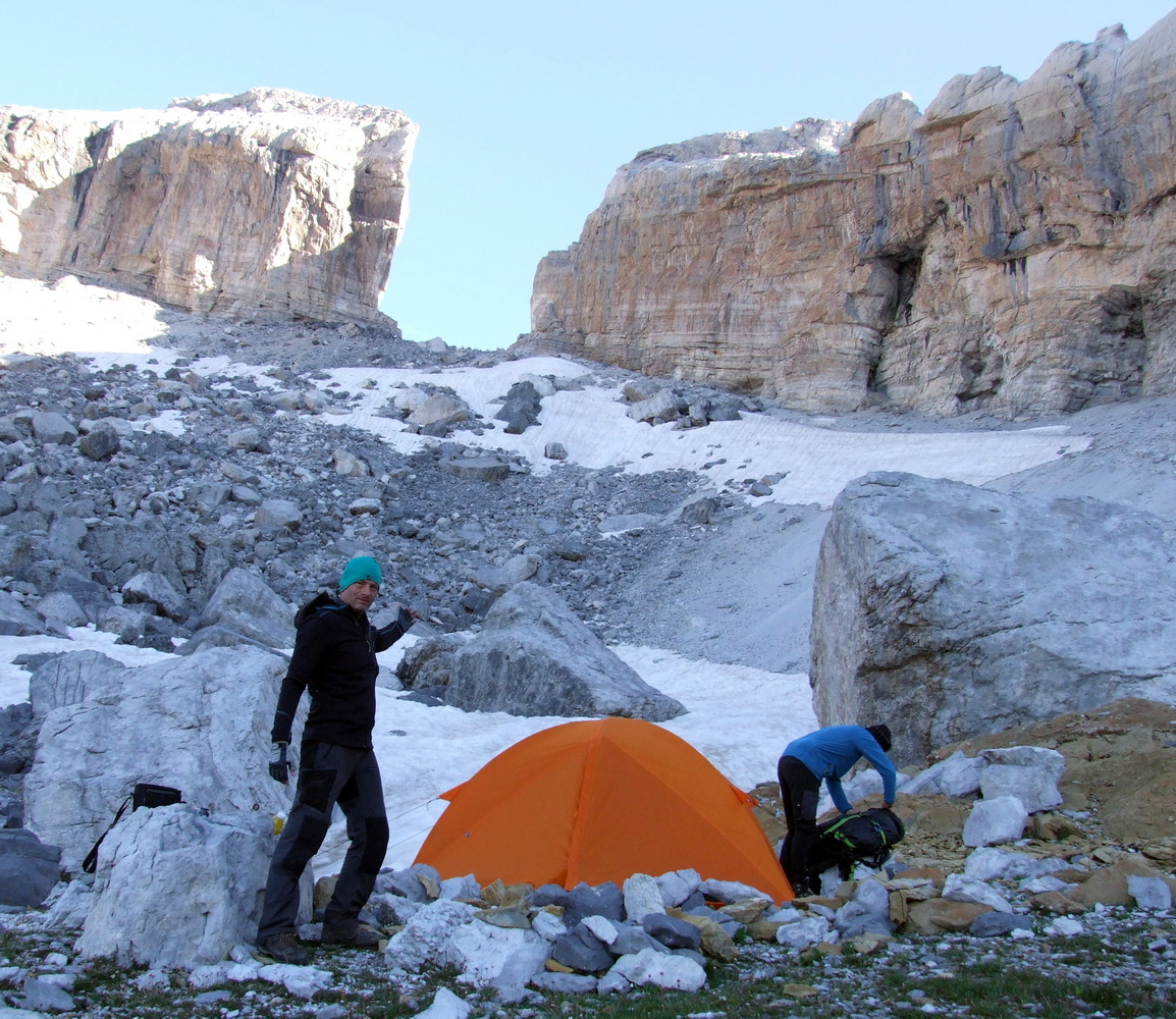
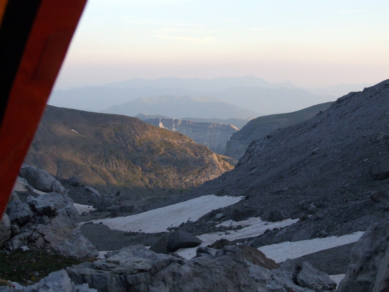

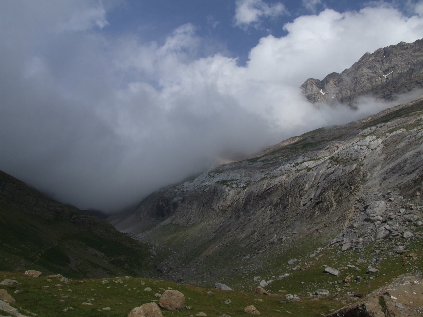
We took it easy the next morning and let the sun come up for a bit before we got out of the tent and got ready to continue. It was clear weather which was promising for the view up the mountain pass. The climb we had in front of us was several hundred meters and it would be very exciting to get up on the mountain ridge and look into the French side. There on the French side was a mountain hut Refuge des Sarradets which lay a few hundred meters down the valley on the other side. We walked slowly upwards and just came out into the morning sun. The temperature rose and we both felt a bit dull after several days of hiking in the sun and rough terrain. We saw nearby activity up the pass and also met some hikers who were on their way down into the valley we came from.
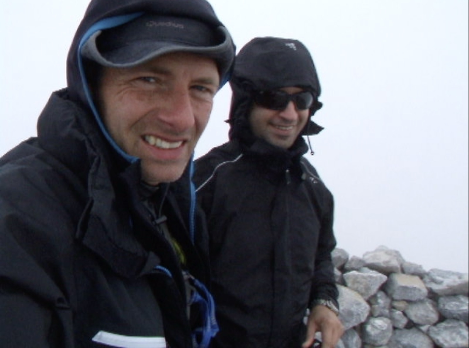
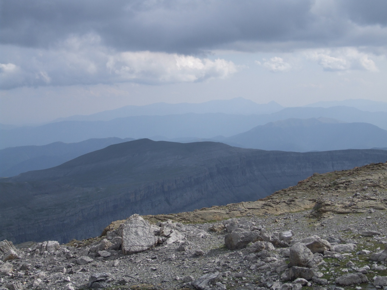
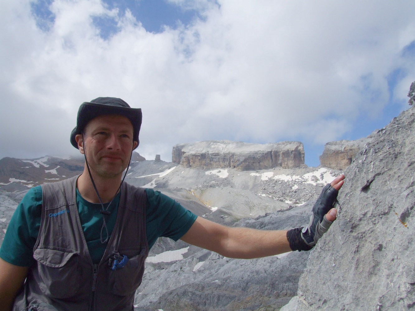
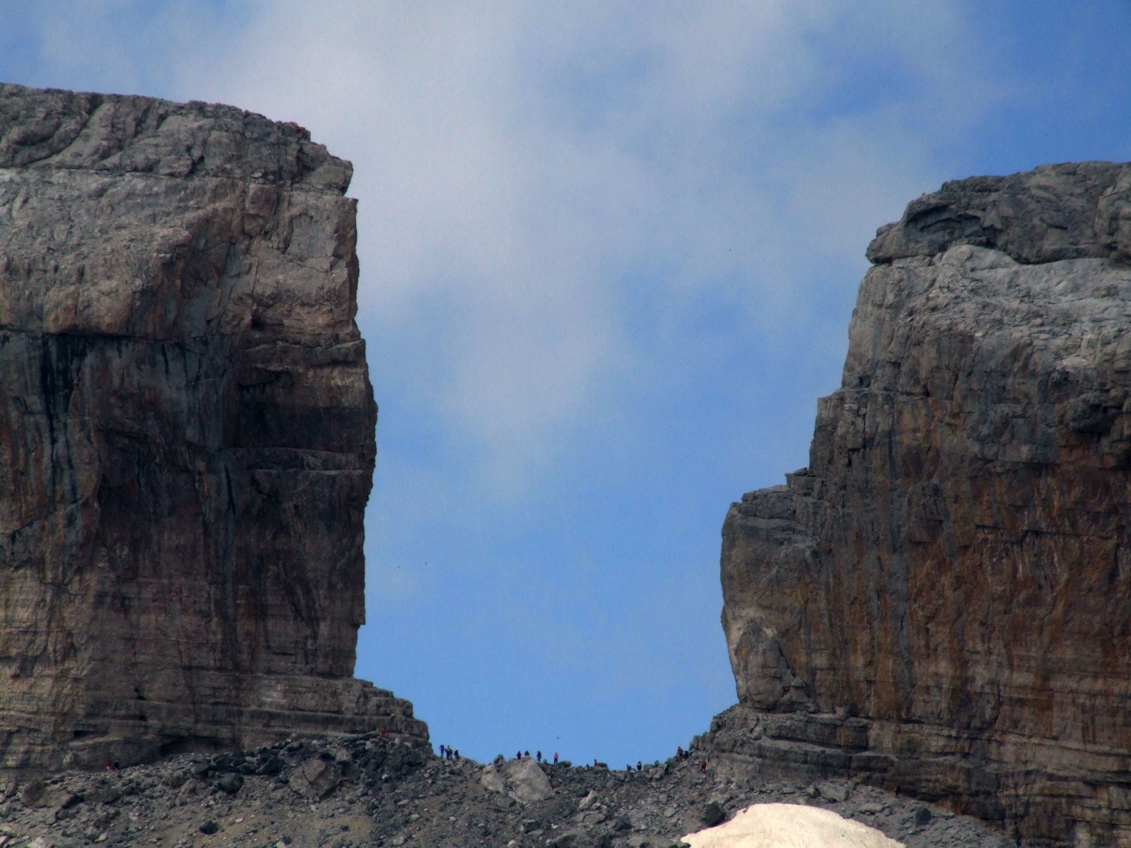
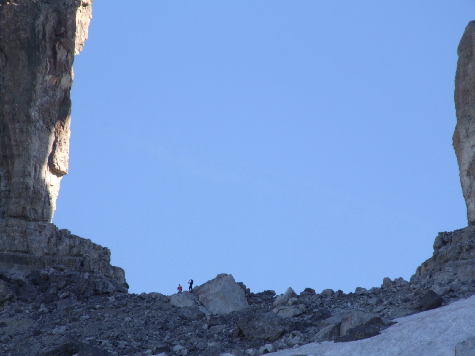
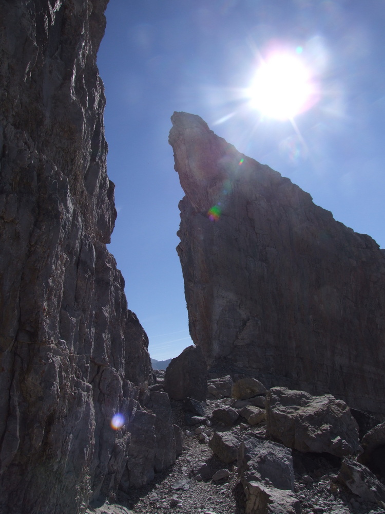
As we approached the ridge there were mighty rock walls standing directly above and it was really like stepping into a giant gate when we were suddenly in the middle of Spain and France. It was a very lovely feeling to have reached this vantage point and with blue skies we could see many miles in either direction. The greenery some way into the French side stood out making the mountains very beautiful while if I turned my gaze back into Spain it was a completely different climate, dry and rocky but also beautiful in a different way. The contrast was phenomenal. Me and my friend were very excited about another milestone on this tour and for me this was the highlight of this adventure.
There were quite a lot of people coming up from the mountain station on the French side to look at the view up here and most of them were not packing but were going to turn down the same road. We had a much needed break up here on the border but eventually we'd descend a snow-covered steep and make our way to the next cabin. We had almost no water left and there was going to be lunch down there.
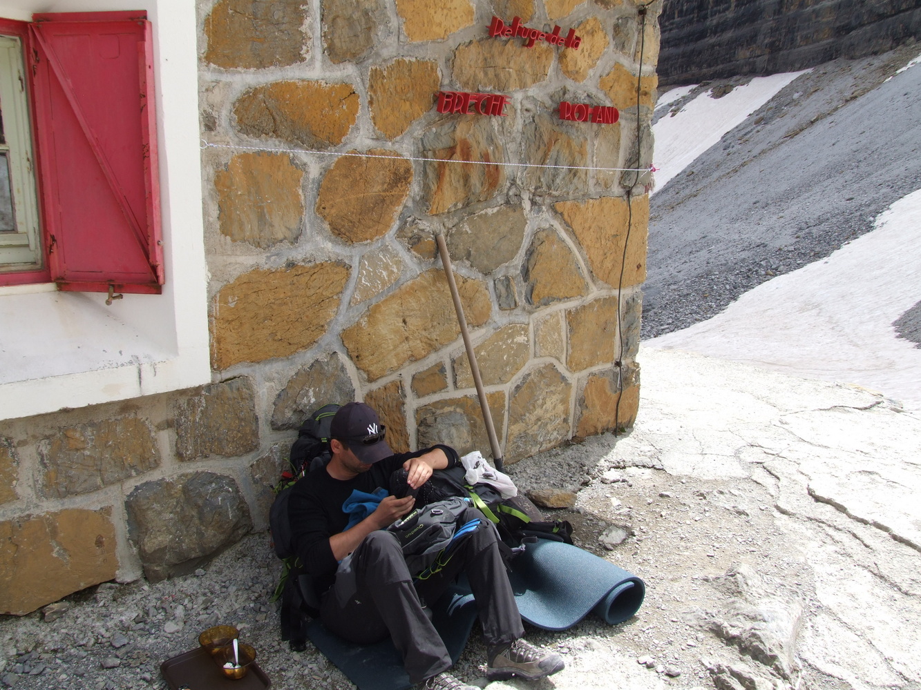
Going down through the snowfield on the French side was the beginning of a long descent and from here we would not climb more meters of altitude again which made the following days easier. We stopped at the Refuge des Sarradets mountain hut on the French side and took a breather. Here there were a lot of people walking up the pass and down through the valley where we would continue. But now we needed to replenish with water and energy. My friend who hadn't eaten since lunch yesterday was pretty tired because his stomach hurt. It wasn't that far left now, another day and a half hiking roughly and then we hoped to be back at the starting point tomorrow night or the following morning.
After a good break at the mountain station we continued down the valley and we met many people and also a squad of young soldiers who probably had some sort of field test or training in getting up. The views during the walk down were very beautiful. Another great day began to draw to a close.
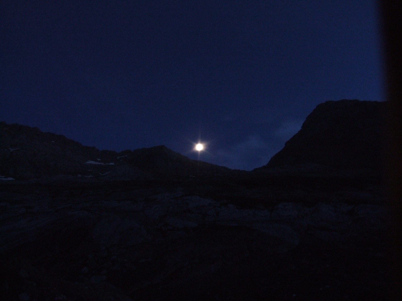
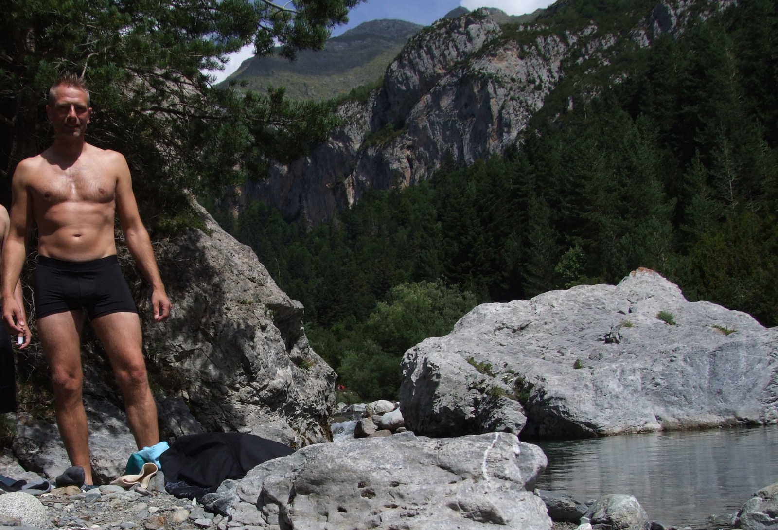
We had hiked up and over the pass at 2800 m.a.h down to about 2000 meters, which was enough for the day when we made it about 8 km. We were making arrangements for another tented night in the mountains when the fog began to creep up and everything came to a standstill in the moonlight. On the last day we came again to hike along the river Rio Ara whose tributary we had started this trek at five days ago. The lower we got, the warmer it got and when we caught sight of the river we celebrated with a joint dip in the icy mountain water. Very cool on this otherwise hot and rather long final day. When we got to Torla and were back where our hike started, both me and my friend were thoroughly exhausted. On this day we had hiked another 15 km and in total this hike was about 50 km with the top climb of Monte Perdido included. Then I have counted off about 10 km from the total distance in my GPX file because I see that my GPS put an incorrect track on the first day as I mentioned and also when we were inside the cave on the third day. You can find the trail from the hike at the top of the page.